Evidently WordPress has a 3GB limit on upload space, and after 6+ years we’ve reached our cap.
From now on we’ll be posting on a new site, “matt and allison 2”. Here’s the link:
Evidently WordPress has a 3GB limit on upload space, and after 6+ years we’ve reached our cap.
From now on we’ll be posting on a new site, “matt and allison 2”. Here’s the link:
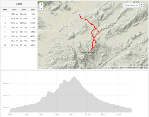
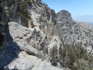
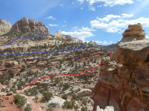
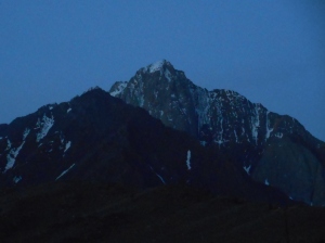
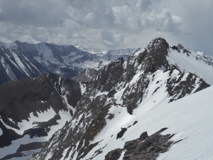
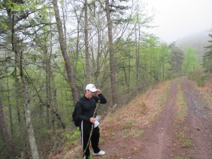
Alex and I had one more day to kill in Montana before flying back to Ohio, so at the last minute we decided to explore a different corner of the state. Up until the day before, we had been planning to use Sunday to climb Sphinx Mountain in the Madison Range near Big Sky. Instead, we drove 4+ hours to the Beartooth Range just south of Red Lodge.
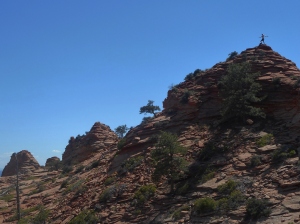
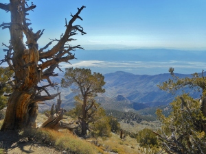
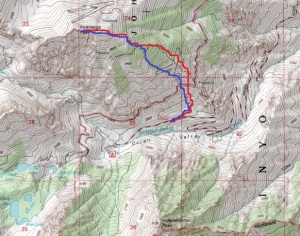
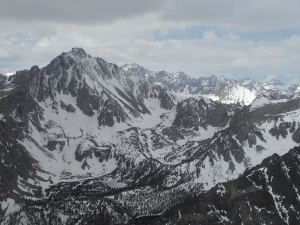
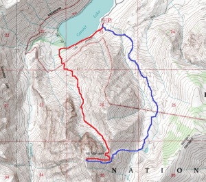
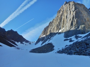
We set off around 6:30 AM, and reached the road to the Spirit Mountain trailhead around 10:30 AM. Unfortunately, the last 7 miles was a very rough dirt road…a little too rough to attempt with the rental car. We’d known this might be a possibility based on internet reports, so had already printed maps for our Plan B: Lonesome Mountain. This required another short (but scenic) drive over Beartooth Pass to the Wyoming side of the range. (The mountain itself is located a few hundred yards north of the Montana border, but most of the approach is in Wyoming).

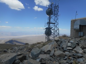
Beartooth Pass
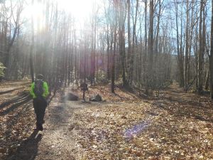
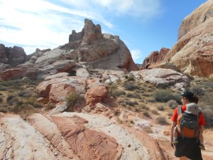
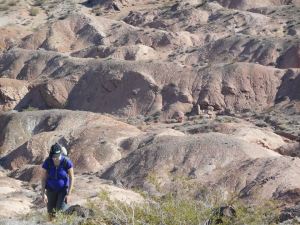
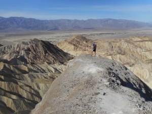
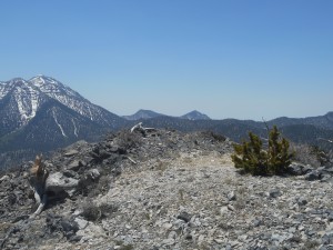
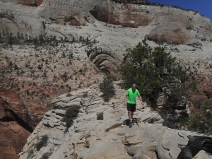
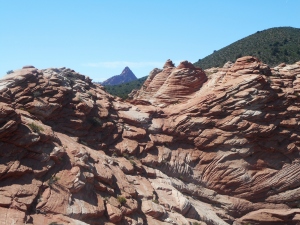
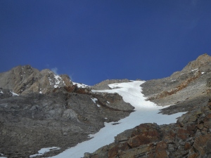
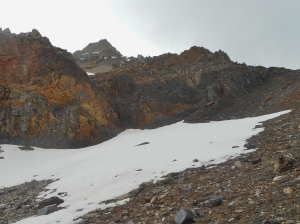
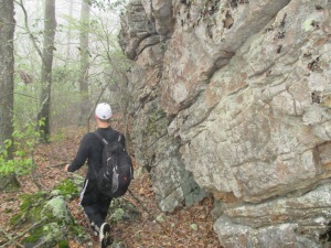
We set out from the Beartooth Lake trailhead and made good time for the first few miles on well established trails. We eventually had to leave the trail and travel another couple miles across open country to the foot of Lonesome Mountain.

View toward Lonesome Mountain, just before leaving the trail
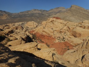
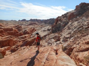
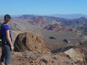
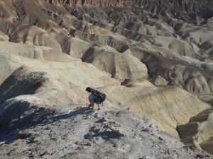
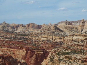
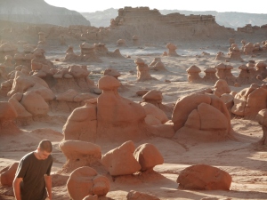
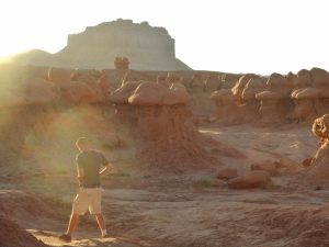
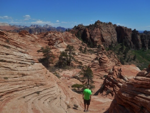
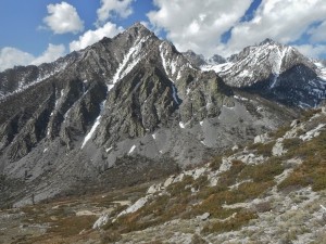
The landscape was pretty amazing; the only real downside was the mosquitoes.

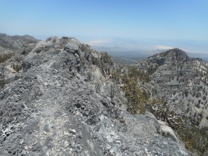
Mountain terrain; view to the west

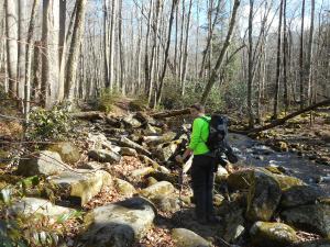
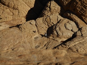
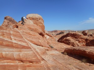
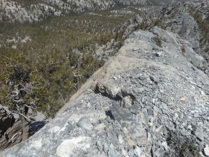
Climbing the south ramp of Lonesome Mountain
As with Wilson Peak a couple days before, most of the climb was straightforward class 2 rock-hopping.

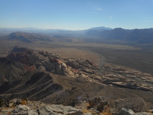
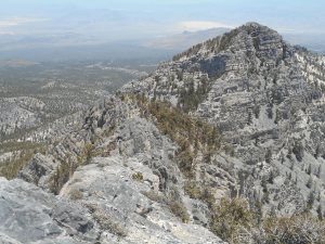
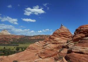
Panoramic shot from the foot of Lonesome Mountain
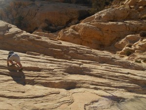
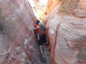
We scrambled up a few light class 3 sections, but even most of these are probably avoidable with enough patience and careful route-finding.

Easy scrambling
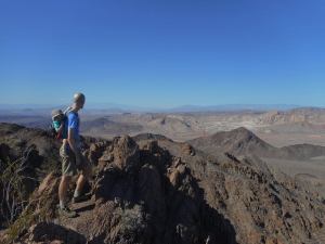
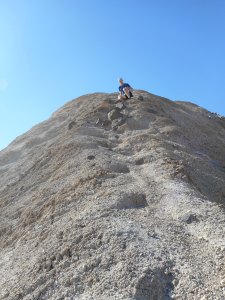
We made the summit 3 hours 4 minutes after leaving the trailhead, although it definitely felt longer.

Topping out at the summit
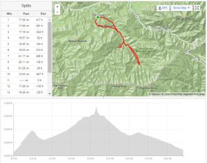
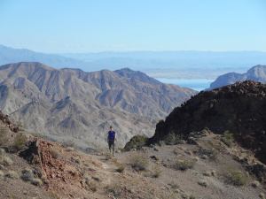
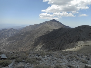
After a short rest on the summit, we retraced our steps back to the trail, then opted for a slightly longer return trip by continuing east on the main trail – eventually looping back to the trailhead at Beartooth Lake. In terms of scenery this was probably a top 3 climb for me, personally.
Total distance was 12.6 miles, with 3042′ of elevation gain. It took us 6 hours 24 minutes including stops.

On day 3 of the wilderness medicine conference, Alex and I decided to take things easy after having hiked the equivalent of a marathon (and roughly 8000′ elevation gain) over the previous 48 hours. So we drove down to Yellowstone and checked out some of the geysers, hot springs, and waterfalls. Nothing groundbreaking, but a few pictures:

Mystic Falls

hot & malodorous water

Bison causing a traffic jam
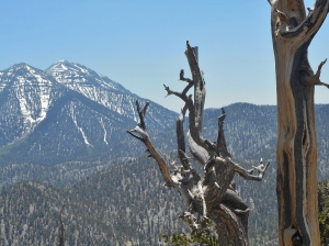
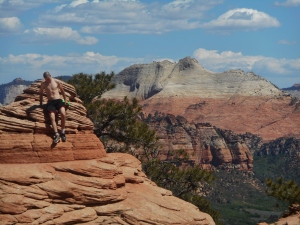
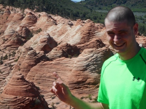
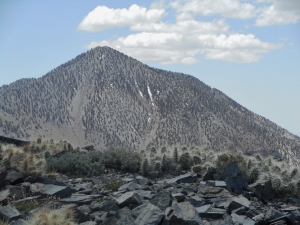
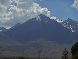
On our second day in Montana, Alex and I decided to tackle a slightly more ambitious climb. When conference ended around noon, we drove a short distance from Big Sky to the Dudley Creek trailhead and spent most of the rest of the day climbing Wilson Peak (10,705′).
The peak itself is one of the more prominent high points on the skyline, seen from Big Sky resort:

Wilson Peak, seen from Big Sky
The first 5 miles is a gradual uphill climb – on a well maintained trail – to Dudley Lake.

A couple miles up the trail

Ascending the trail to Dudley Lake
This 5 mile stretch gains ~2800 vertical feet, leaving another 1.25 miles and ~1500 vertical feet of off-trail climbing. The climb itself is mostly easy class 2, with the exception of a 50-60 foot summit block requiring a few class 3 moves.

Climbing up from Dudley Lake (seen below)

Alex standing on a ridge, just below the summit

One of the class 3 sections

More class 3
We reached the summit in a little under 4 hours. We spent 20 minutes or so taking pictures and eating some snacks, before we decided to start heading for the car.

Summit Panorama
There were several ominous storms on the horizon, along with the occasional rumble of distant thunder, but fortunately we never had to deal with more than a few light sprinkles or rain on the return trip.

Descending
The entire round trip took 6:41, including rest stops. Total vertical gain was 4578′. Total distance was 12.5 miles.

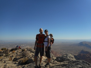
Last week I attended the National Conference on Wilderness Medicine in Big Sky, Montana, along with four other ER residents from my program. During our free time, Alex and I took advantage of the opportunity to squeeze in some hiking.

Picture with Jordan Spieth
As a side note, we ended up sharing a flight with Jordan Spieth from Dallas to Bozeman, so we got to meet him and get some pictures. He’d just won the British Open a few days before, but was flying in coach with his family, then stood in line with us at Budget to rent a car.
Our conference sessions took place mostly during the mornings, so the first afternoon Alex and I drove down to the edge of Yellowstone NP to hike to the top of Bighorn Peak (9,930′), just north of the Wyoming border.

Bull Moose
A couple miles into the hike, I looked up to our right and spotted two bull moose. They kept a close eye on us for a few minutes, then wandered off into the trees. I turned to Alex and said, “You know, the last time I ran into a bull moose this close, Allison and I saw two grizzlies just a few minutes later…so keep your eyes peeled.” (Here’s the LINK, from 2012)
Almost exactly five minutes later, I looked up again and saw a bear.

There’s a bear over there
Of course we hadn’t brought bear spray (not allowed in carry-on bags), but fortunately he didn’t get aggressive with us. Just stared us down for 30 seconds ago, then climbed up onto a fallen tree and slowly moved away.
We didn’t see much more wildlife after that, and managed to reach the summit 20 minutes or so before a thunderstorm rolled in. This gave us just enough time to jog back downhill and under tree cover.

Standing atop Bighorn Peak
The total round trip distance ended up at 12.2 miles, with 3,178′ elevation gain.

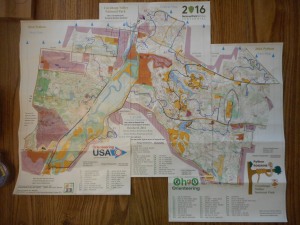
The weekend before last (June 24-25), my brother and I drove up to Michigan for an 8 hour overnight rogaine. The course was similar to last year’s race (link), but slightly more compact and with some interesting new flag locations.
My brother and I were both pretty exhausted before the race even started – he was coming off a 24 hour EMS shift, and I had just finished a week in the ICU and was getting ready to start another 80-90 hour work week on Monday. So we ended up doing a lot more hiking than jogging.

Getting ready to start
Maps were distributed at 8pm, so we spent the next couple hours planning our route before the race started at 10pm.

Course map
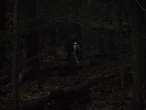
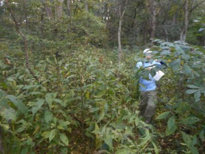
We started with a short loop, hitting #43, #40, and #31 before making our way to the southeast section of the map – a newly added area since last year. We found #35 easily enough after plowing through chest-high grass under some power lines.

Searching for #35
Our first of two big blunders came when we missed the turnoff for #57. We considered doubling back when we realized the mistake, but decided to just skip it. We continued on to #54 and #68 with no more problems, then started making our way westward along the southern edge of the map. This area was pretty rich in points, and the trail network allowed for quick movement. We picked off #59, #65, #77, #75, #32, and #34, then jogged down the road to another trail, which we followed to #47, #37, #64, #35, #76, #39, #66, and #44…each requiring only a short ~2-10 minute detour off trail.
We were tempted to go for three high-value controls along a peninsula on the southwest edge of the course, which would have required a more extended off-trail bushwhack…but I had some bad memories of getting tangled up in briars in that section last year, so we instead doubled back along one of the main roads toward the center of the map. Along the way we went for #71, but managed to miss it completely (our second major blunder of the night, costing us 70 points and at least 10-15 minutes). Looking back at the GPS track after the race, it looks like we overshot it and ended up making a large circle around #71. Oh well.

Tagging one of the controls…I think maybe #76?
The central section of the map was also pretty densely packed with controls, but unfortunately we were starting to feel a little pressed for time, and wanted to leave ourselves enough flexibility to get the handful of high-value controls near the start/finish area. So instead of clearing this entire area, we made a short loop of #33, #67, #52, and #81 (skipping #42, #56, and #74). This left us enough time to clear most of the rest of the controls near the start/finish area. We finished the race by hitting #63, #60, #80 (which we nearly missed…it was tough to spot on a small island in the middle of a swamp, accessible only by a small wooden plank, or by swimming), #79, #78 (we were running, by this point), and finally #46.

Outline of our route

GPS track
We finished with a few minutes to spare, and ended up placing 9th out of 21 teams. Had it not been for those two dumb mistakes, we’d have finished 6th, so overall not too bad.

Our total distance for the night was 19.5 miles, with 2,060 feet of elevation gain. By the time I drove home, took the boys to the Dayton Air show the following day, and finally made it to bed, I’d been awake for more than 32 hours…so my memory of this race is unfortunately kind of hazy.
I added some photos of our day hikes in the Smokies (for a full write-up, see Allison’s posts HERE and HERE).
The first day hiking with the boys – an out and back to Cane Gap (7.9 miles, 893 feet elevation gain, a couple miles of which was just Dad, Caroline and I). We’d initially planned to make a loop via the Rabbit Creek trail, but had to change plans to avoid wading across a knee-deep stream with no bridge crossings.

Micah at our cabin
The next day we did a 5.1 mile out-and-back hike to Abrams Falls.

Micah at Abrams Falls

Allison and Ezra on the Abrams Falls hike
Day 3 was a short walk up to the top of Clingman’s Dome, followed by a short stretch on the Appalachian Trail.

Micah on Clingman’s Dome

Ezra on Clingman’s Dome
Day 4 was the 26.1 mile mega-hike that I did with Trent (see previous post).
On day 5, we took a short 1.1 mile hike to Cataract Falls, then went into town for a game of putt-putt golf (Allison+Ezra came in 4th, I came in 3rd, Micah came in 2nd, and Grandma R won by a stroke).

Cataract Falls

Micah golfing
Last week we met my parents and sister Caroline for a week in the Smokies (separate blog post incoming), and my brother and his girlfriend Kelsey were able to come for a few days too. My brother and I spent Friday (6/2/17) completing another one of my bucket list hikes – a south to north traverse of Great Smoky Mountain National Park. (Roughly speaking, that is…technically we started about a quarter mile inside the southern border, and finished about a quarter mile outside the northern border).

Total distance 26.1 miles; total elevation gain 6,164 feet.
We left Trent’s car in Gatlinburg, and Dad was nice enough to drop us off in Smokemont at 6:30 am so we could get an early start.

Climbing up toward the AT
The first 4 miles or so was a very gradual uphill walk along a stream, so we knocked it out in just a little over one hour. After that, the trail began winding more steeply uphill for another 4+ miles until connecting with the Appalachian Trail, just east of Charlies Bunyon.

View from the AT
Fortunately we reached the higher elevations before the heat of the day set in, and stayed above 4000 feet for most of the day.

Near Charlies Bunyon

Charlies Bunyon
We followed the Appalachian Trail for a few miles before joining up with the Boulevard Trail, which we followed for another ~5.4 miles to the top of Mt. LeConte. Along the way we stopped for a short detour to see the Jump Off – a steep cliff offering some more partially cloud-obstructed views.

Trent and I at the Jump Off
We made it to Mt. Leconte around 1pm, taking another detour along the way to see Myrtle Point.

Myrtle Point

“True Summit” of LeConte
There are 5 different trails leading to the Summit of Mt. Leconte, with lots of interesting history and “trail records” between them (fastest time to climb all 5 trails, most total times climbing all 5 trails, fastest time up and down each of the 5 trails, etc.). About a year and a half ago, Trent and I got to do 3 of the 5 trails by climbing LeConte twice in a day (SEE HERE).
So by ascending via the Boulevard and descending via Rainbow Falls, we were able to finish #4 and #5 to complete the list. Interestingly, the Bullhead Trail which we did previously is now closed because of damage from the wildfires last year.

Areas of fire damage on the Rainbow Falls trail

Looking down toward Gatlinburg from halfway up LeConte

Rainbow Falls
We finished almost exactly 11 hours after leaving from Smokemont, including an hour or so of breaks for food, pictures, etc.
This was my second consecutive year doing the Stokesville Rogaine – a 24 hour navigation/adventure race in the mountains near the Virginia & West Virginia border. You can read about last year’s race with my friend Phil HERE.
This year I again signed up for the 24 hour option, and Bruce joined in to race the 6 hour option.

Our campsite for the weekend
We camped out overnight on Friday, then got up early on Saturday morning to collect our maps at 0700. The window for starting was 0800-1000, after which I’d have 24 hours to collect as many points as possible. We spent awhile mapping out our route, then headed off at 0847.

Getting ready to start
The weather was a little cool (high 30’s at night, high 50’s during the day) and there was some light rain off and on, but overall much more favorable conditions than Phil and I deal with last year. There had, however, been heavy rain a couple nights before, so many of the local streams and rivers were flooded – necessitating a few last minute adjustments on the course. A few controls were re-located, and one of the larger rivers that Phil and I had waded across last year was not only passable via several bridges.

Course map, for those who want to follow along
Bruce and I stayed together for the first 3 hours or so, grabbing #31 and #44 on our way out of the campground. From there we worked our way along a steep hillside adjacent to one of the flooded rivers, until we found #51 (one of the controls that had to be repositioned to higher ground after the flooding).

Looking back southeast in the direction of #51
On our way to #62, Bruce and I briefly got separated when he doubled back to grab something he’d dropped, but we met back up around #62. The terrain was very steep in some areas, so it was slow going.

One of the cliffs alongside the river
Our pace improved over the next few hours; we climbed the ridge to our west and met up with a trail, which we followed uneventfully to #77, #72, and eventually to #95 atop Lookout Mountain.

Bruce collecting #77
We parted ways on Lookout Mountain. I went on to collect #45 before heading toward the western half of the map, while Bruce finished his 6 hour loop hitting #45 followed by a handful of other controls closer to the campground (I was saving these for the following morning).

Control #95 atop Lookout Mountain
After #45, I took my first real foray into the woods, collecting #65 and #76 by side-sloping more than a mile of steep, trail-less terrain. I was a little out of practice having not done a rogaine in nearly a year, but was able to manage by carefully counting each of the reentrants and spurs as I moved west, and guessing as best I could at the elevation. No issues with these two. I met back up with another dirt access road, which I then followed back to the main road and one of the bridge crossings.
This is where I made probably the dumbest error of the day. I’d decided to forego several of the controls between Trimble Mountain and North River Gorge in order to save time, so I picked up #43 and then continued northwest up the road. In hindsight, it would have only taken an extra 15-20 minutes and minimal effort to double back for the higher value #84, which was only ~600 meters further to the east. Instead I went for #54 (which had apparently been lost/stolen…so I never found it, but got credit regardless).
From here my thought was to grab #42, #64, #81, and #71 before hiking back down the main road to Stokesville campground for dinner. I figured I would then head back out for another loop after dark, picking off some of the easy & high-point value controls near trails and roads during the night hours to minimize my time floundering around in the woods at night.
I ended up making better time than expected, so by the time I reached #71, I decided, “why not add an extra kilometer to get #82, too?” Then things kind of snowballed from there. As you can tell from the contour lines, the terrain is relatively more flat on the western half of the map, and there also happened to be fewer briars and mountain laurel patches to contend with. I could practically jog through the woods. The “just one more” routine ended up taking me from #82, up a long spur to #47, across a broad ridgeline to #37, through some thicker brush to #91, down the road to #83, then down a painfully long creek bed to get #61 and #96 on my way back to the main road.

View from a field just south of #83
I then followed the road for another 5 miles or so back to the campground, taking brief detours to grab #56 and #98 along the way. I had to flip on the headlamp not long after leaving #98, but made it back to the campground around 2120. Although I could have easily netted more points by staying out for one large loop rather than doubling all the way back to the campground, I figured it was worth it for the chili, beer, warm campfire and pork sandwiches.
Around 2230 I headed back out for a smaller loop, climbing up the east side of Grindstone Mountain and hitting controls #87, #93, and #86. I then backtracked a little ways down the road and followed a trail up to the spur just northeast of #88, which I then found uneventfully. And then, why not, I made another small detour to pick up #34 on the way back to the campground for a second time. It was around 0300, while walking down the road, that I spotted a bobcat watching me from a few meters into the woods. So that was pretty cool. Didn’t see much else in the way of wildlife.
I made it back to the campground sometime around 0400, then took a nap from 0430 until 0600. At this point I only had another 4 controls (plus 1 bonus control) within easy walking range, so I figured I’d collect them after the sun came up.
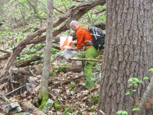
I was pretty sore at this point, having already covered roughly 40 miles, but managed to get my legs working again and headed up a nearby stream to controls #41 and #36 – which happened to have instructions posted for finding the bonus control not marked on the map.

Instructions for bonus control #74
I measured out the distance and direction on my map, marked the spot, then headed first to #52 before then circling around to find #74 without any trouble. Finally, I ended the day by following a faint trail down another ridgeline to #63 and then returning to the finish area.

I ended up finishing #8 out of 18 in the 24 hour category.

My route, outlined in purple
Approximate total distance was 43 miles, with ~8,000′ elevation gain.
Allison and I were both a little worn out after carrying the boys 10 miles on day 1 of the trip, so we decided on a more relaxed pace for days 2 and 3.
On the second day, we spent the morning at the hotel pool (Ezra wasn’t a fan; Micah had a great time), then let the boys take a nap before driving into Shenandoah for a short afternoon hike to Turk Mountain (2.4 miles round trip, 661 feet elevation gain).

Micah and I atop Turk Mountain
Micah wanted to hike most of the way himself, but I did have to carry him up a few of the steep sections. He had a great time scrambling on the rocks at the top. Ezra seemed to enjoy the hike, too.
On the third day, we checked out of the hotel in the morning, hit the grocery store to stock up on camping food/supplies for the weekend, grabbed lunch at Cracker Barrel, then drove back into the park for one more short hike. This time Micah climbed all the way to the top of Little Calf Mountain without any assistance (3.7 miles round trip and 488 feet elevation gain, including a few short side-tracks along the way). I offered to carry him a few times, but got a firm “NO!” in response.

Micah climbing up Little Calf Mountain

Standing at the summit

Water break
So I guess this was technically Micah’s first mountain climb.
After finishing, we drove ~45 minutes to Stokesville, Virginia and met up with Allison’s parents for the camping/rogaine weekend.
By using a combination of leftover paternity days and front-loading my monthly ER schedule, I was able to take all of last week off work. We decided to head down to Virginia for a few days of hiking with the boys in Shenandoah National Park, leading up to my 24 hour Stokesville Rogaine on May 6-7.
After driving down on Tuesday, Allison and I had three full days with just the boys, after which we planned to meet Allison’s parents for a weekend of camping in Stokesville. For our first day of hiking, we took Micah and Ezra on a fairly ambitious loop of Blackrock and Trayfoot Mountain.

GPS route
According to my GPS watch, we covered 9.7 miles and 2273 feet of elevation gain over 4.5 hours (not including a couple stops along the way for Ezra to nurse).

Hiking to Blackrock
Micah walked alongside us for a few short stretches, but for most of the day the boys rode along in their carriers – Micah on my back and Ezra on Allison’s front.

Allison and Ezra atop Blackrock
The loop first took us atop Blackrock, a scenic sub-peak of Trayfoot, then continued on to the top of Trayfoot Mountain. Micah cheered us on to “keep hiking up to the peak!”

Micah and I near Trayfoot’s summit
The boys both took naps along the way.

Ezra taking a nap…

…and Micah taking a nap
We made it back to the car late-afternoon, then had a nice dinner at a local burger place in Charlottesville.
My brother, Aaron V. and I had planned an ambitious ~25 mile hike in the Smokies for Dec 29, 2016. The goal was to leave from Elkmont, climb Clingman’s Dome via a 2-mile off-trail ridge just south of campsite #30, then double back via the AT and the Goshen Prong Trail. It didn’t quite go as planned, but still a pretty good time.
The first setback came at 3am as Allison, Micah and I were driving through Cincinnati (the plan was for them to drop me off in Louisville, where I’d meet up with the other guys and Allison would continue on to Newburgh for the holidays). I got a phone call from my brother saying he’s eaten a bad batch of cuttlefish the day before, and now had bad GI upset and wouldn’t be able to make it. So I met up with Aaron near Louisville, and the two of us continued on as planned.
Early in the day
Little River Trail
We kept up a quick pace (~3.4 mph) for the first 8 miles, when we reached campsite #30. From here, we were only a little over 2 miles as the bird flies (and several thousand feet vertically) from the top of Clingman’s Dome. We left the trail, and over the next two hours managed to cover approximately…a quarter of a mile.
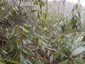
It turns out this area is completely overgrown by very thick rhododendron. We spent much of the time army crawling, and the rest of it picking our way tediously along on foot.
The way forward

Forced to army crawl
After a couple hours, it became apparent we wouldn’t be making it to the top of Clingman’s. So we reluctantly doubled back to the trail, which meant doing battle with the rhodo all over again.
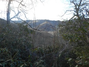
View through the trees
Never-ending rhodo
We took a short side-trip a mile or so up the Goshen Prong trail on the way back, so our total distance ended up being around 18 miles. The most intense part of the workout, however, was the 4 hours (and few hundred meters) we spent off trail.
Crossing a stream
We headed back to Red Rock Canyon for the final day of our trip (11/7/16). I had hiked Turtlehead Peak (6,324′) almost exactly one year before, while interviewing for residency in Las Vegas, and thought it would be a good hike for the family. Since we had the entire day (overnight flight home leaving around 10pm), we made it a combo by adding a side trip to Calico Tank Peak (4,870′).
View from the top of Calico Tank Peak
A relatively short trail (1.5ish miles) took us to the Calico Tank (which didn’t currently have any water), where Allison stopped with Micah and let him play on the rocks for 20 or 30 minutes. I used the time to climb the rest of the way to the summit, a short climb of a few hundred feet, with one short class 3 chimney that required a little bit of effort.
Looking back down on Allison and Micah, from just below the summit
Looking toward Turtlehead (top right) from the summit of Calico Tank Peak
Micah climbing on the rocks
We then retraced our steps to where the trail forks, and started the long uphill hike to the summit of Turtlehead. Micah was in a cheerful mood the entire day, despite the heat and the long stretches of riding in his carrier.
Looking back down toward Calico Tank and the parking area, from Turtlehead’s summit
Family picture
We made it back to the car around 2pm, then drove back into Summerlin for a late lunch at a pizzeria. By the time we finished, we had time to squeeze in one more short hike (which we let Micah walk along for) in the Calico Basin area. Then it was time to return the rental car, take our shuttle to the airport, and fly back to Cincinnati.
A nice vacation; now for a month of long hours in the ICU…
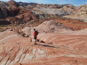
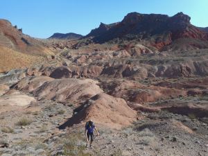
On day 4 of our trip, we did a few hikes in Valley of Fire National Park – about an hour’s drive northeast of Las Vegas.
The first hike was a short, ~1.4 mile out-and-back trip to see the well-known ‘Fire Wave’ rock formation.
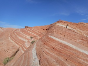
Fire Wave
View of the park
Our longer hike took us down the White Domes loop, then connected up with the Prospect Trail. Near the White Domes, we passed through a short slot canyon, which Micah was fascinated by.
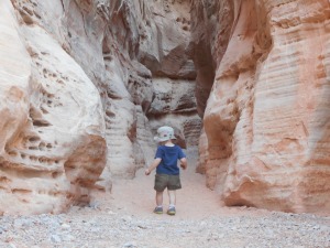
Slot canyon
The Prospect Trail is a little over 5 miles one-way (10-11 miles round trip), but as we quickly learned, the trail isn’t exactly easy to follow. I’d expected it to be well-marked, so I hadn’t brought along any maps. The trail snaked through numerous canyons, forking into several unmarked trails, and I’m pretty sure we ended up losing the main trail in the process.

Climbing on some of the rock formations
Hiking through the canyons. Do we go left or right?
We hadn’t planned to hike the entire trail, though, so it didn’t really matter. We explored a few side canyons, before eventually backtracking and returning to the car.
Tight squeeze
Another network of canyons
At one point we stopped for a break on a large, slanted slab of rock, and let Micah get out of the carrier and practice his climbing skills. He was surprisingly coordinated on the uneven surface, and did a nice job of imitating what he had seen us do – climbing uphill on all fours, then turning around and crab-walking down feet first.
Practice going up…
…practice going down
We stopped for a late mid-afternoon lunch in Overton, NV, and I was even able to catch a few minutes of the Colts game while we ate.
Rather than returning to the hotel via the interstate, we took the scenic drive along Lake Mead, stopping along the way for another short hike, which we let Micah walk for rather than riding in the carrier.
Day 3 of our trip was Hamblin Mountain – one of the larger mountains in the Lake Mead area that’s technically part of the ancient Hamblin-Cleopatra volcano, which has since been split apart by earthquakes. Of all the hikes we had planned for the week, this is probably the one I was least excited about, but it turned out to be our favorite.
Our route
The entire hike took roughly 4.5 hours (splits above don’t account for stops). There were trails in some places, but not reliable enough to follow to the top without a map. I used a map I’d found online to get us to the summit, though we ended up finding a much faster/easier but less scenic route down. We mostly followed ridgelines on our way up, and stream beds and washes on our way down.
Heading up the first ridge
…getting higher…
There were a few steep, rocky sections along a few of the ridges, but it’s no more than a class 2 hike. At one point a large raven followed us overhead, and I mistakenly called it a crow…so Micah spent the next 20 minutes pointing at it saying, “Cuh! cuh! cuh!”.
Along the summit ridge, we finally caught sight of Lake Mead to the south. The views were outstanding. It was also around this time that I nearly stepped on a small snake. Micah correctly identified it as a “Sneh”.
View of the Hamblin-Cleopatra Volcano
And what sound does a snake make, Micah?
“Sssssssssss”.
Micah and I taking in the view
Allison (center) & Lake Mead (top right)
We stopped for a snack at the summit, and gave Micah a chance to get out of his carrier and run around (watching closely to make sure he didn’t run off the side of the mountain). He seemed to enjoy that a lot.
Micah at the summit
He wanted to go “that way”.
You can see from the elevation profile above that our return trip had a lot fewer ups and downs, as we basically just followed the path of least resistance down various stream beds. This would be the way to go if you’re in a hurry to make it to the top, but we thought the ridges were more enjoyable (even though they required more effort).
When we finished the hike, we decided to drive further south the visit the Hoover Dam, since none of us had ever seen it before. I don’t think Allison liked it when I taught Micah how to say “dam,” but he picked it right up.
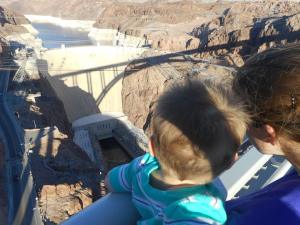
“Dam dam dam”
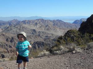
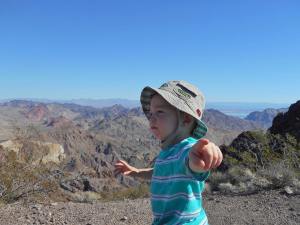
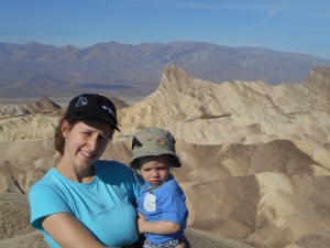
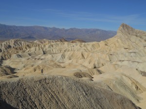
For the second day of our trip, Allison, Micah and I got up early(ish) to drive over to Death Valley National Park. You might remember a post from a few months back, when I climbed Telescope Peak in Death Valley. At the time, I noticed the impressive landscape around Manly Beacon, and added it to my bucket list.
Manly Beacon, from Zabriskie Point
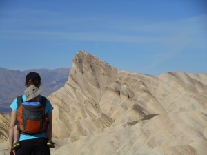
The “summit” itself comes in at a paltry 750′ elevation…definitely not a mountain, per se…but an interesting feature nonetheless. The round-trip distance was only 3-4 miles, about half on-trail and half 0ff-trail. Not much difficulty from a navigation standpoint, so long as you hike up the correct wash and aim for the ridge between Manly Beacon & Red Cathedral.
Manly Beacon (far right)
Getting closer…
Hiking up the ridge
The climb wasn’t terribly challenging, no more than class 2+, but there was a fair amount of exposure along a “catwalk” section near the summit.
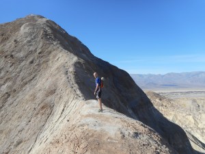
Crossing the catwalk with Micah
Summit photo
Heading back down
A few sections were slippery with loose sand and rock, so we had to crab walk down – which Micah again thought was hilarious.
Micah riding on my back, laughing in my ear
The hike back to the car was uneventful, but very hot. We found a diner within the park, grabbed some hamburgers, then stopped by Badwater Basin (lowest point in the Western Hemisphere) before heading back to Las Vegas.
Tired 18-month-old
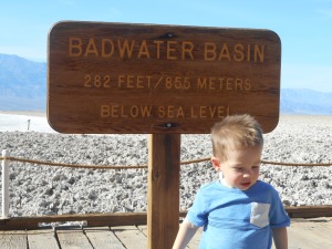
Micah at Badwater
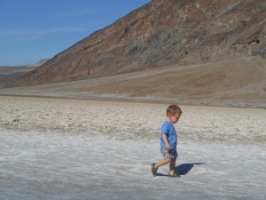
Running around the salt flats
Also, I’m going to go ahead and claim a “Youngest Ever to Stand on the Summit” record for Micah on Manly Beacon (1 year, 6 months, 25 days). Post a comment below if anyone out there breaks his record!
Our family just got back from a 5-day hiking trip to Nevada and California, so I’ll be posting several more times in the coming days.
The trip got off to a slow start, as our flight out of Cincinnati was delayed a couple hours. We arrived at our hotel (the Aliante) after midnight, so decided to sleep in and choose a hiking destination relatively close to Las Vegas for day 1.
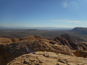
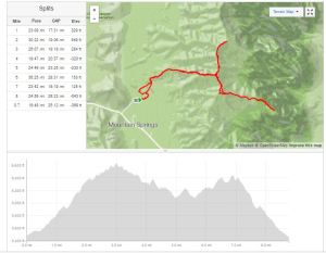
We settled on Mountain Springs Peak and Windy Peak – a couple of class 2 summits on the edge of Red Rock Canyon.
Climbing toward Mountain Springs Peak
The route was a mix of 4WD road, hiking trails, game trails, and off-trail hiking.
View from Mountain Springs Peak
Mountain Springs is a higher, broader mountain with a well-established trail to the summit. Windy Peak, on the other hand, offered some fun rock scrambling over its final few hundred feet. Micah spent most of the hike riding in the baby carrier. Over the course of the week, we noticed that he always spends the first 30-40 minutes silently watching the scenery…then he starts singing songs and babbling…then he starts asking to get down and walk (and/or have a snack).
Micah, just below the summit of Windy Peak
View from the top of Windy Peak
Micah enjoyed the scramble sections tremendously. He thought the entire situation was hilarious. Whenever I had to use my hands to steady myself, he broke out into a belly laugh.
Descending Windy Peak
We finished the hike in a little under 4 hours, then drove into the city for a delicious Mexican lunch. Total distance was 8.7 miles, with a total elevation gain of 1,940′.
Last weekend I met up with Dan Knabel – a friend from med school – for a 12 hour rogaine in Cuyahoga Valley National Park. Special thanks to our wives for watching the kids all day.
pre-race briefing
This was my 3rd rogaine of the year (Dan’s first ever). The map came in three pieces and was blown up to 1:12,500, with a lot more terrain detail than I’m accustomed to. Controls #1-19 were worth 10 points, #20-29 worth 20 points, etc. with a maximum control value of 60 points. (There was also a bonus control worth 60 points to be found via a map attached to an unknown control. Sadly we never found this). Maps were distributed a little after 0700, and the race began at 0800.
Dan and I decided to begin by heading eastward toward the large plateau feature surrounded by cliffs. We would then circle back around toward the corn maze in the map’s southwest corner, make our way north to the other river crossing, then re-evaluate where we were based on time.
Our final route in blue (click to enlarge)
From the starting area, we quickly hit controls #47 and #16 to the east. We then headed toward #17, which we somehow managed to miss completely. We gave up on it after 5 minutes of searching (since it was worth a mere 10 points)…but this ended up being the only control of the day that we failed to find. As we were leaving, we ran into another guy who couldn’t find #17, so at least it wasn’t just us.
Dan bagging #38
We then headed east to #28 and #38, which we found with no issues. We had decided to abandon the southeast corner of the map, since the density of controls was a little more sparse than in other areas. We did however grab #67, #58, and #18 (120 points!) as we moved back to the west. This section was a little brushy in places, but briars were few and far between, and we made very good time.
We mostly followed the road for the next few hours, taking a few short side-trips into the forest along the way to hit #24, #8, #4, #35, #23, #49, #2, #51, #3, and #50 on our way to the corn maze at #60.
Dan navigating the underbrush near #49
Our biggest hiccup of the day came as we were approaching #51. We apparently overestimated the distance we needed to travel before turning downhill, and overshot the target. This normally wouldn’t be a huge problem, but this had taken us off the edge of the map…and we didn’t realize until far too late that were were hunting for #51 on the wrong hillside. By the time we realized the mistake and backtracked, we had wasted at least 35 minutes.
Things went smoothly after that, though. We walked past a few goats after leaving #3, and found #50 underneath a solar panel.
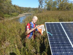
Control #50
The next control, #60, was hidden in a large 3-acre corn maze at the Szalay farmer’s market. We were in & out in about 6-7 minutes.
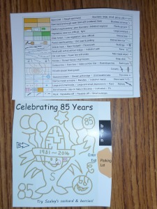
Terrain key (above) and corn maze map (below)
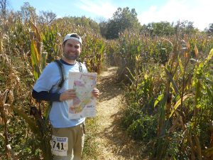
Entering the corn maze

Control #60
We took advantage of the farmer’s market to stock up on apple cider and chocolate covered caramels, which was a solid investment. We then followed the road north toward the western-most section of the map. This was another area with lower control density, so rather than going for all the controls, we only went for the low hanging fruit near the road – #52, #31, #32, #53, and #1. None of these posed much challenge. We then made a quick loop to grab #62, #42, and #33 before crossing back over the Cuyahoga River.
View to the east of #62
After briefly over-shooting #54, we made a quick and efficient northward loop of #34, #63, #55, #64, and #44. At this point we stopped for a few minutes to consider our options. There were 3 hours 30 minutes left in the race, and we were torn between continuing toward the northeastern corner of the map, or retreating back toward the start/finish area and picking off the numerous low-value controls down near the lakes. We decided to go for the higher-value controls to the northeast, which I think was the right choice. It only took 20 minutes or so to grab #43, #12, and #26, then we made quick time walking along the road. A mix of on-trail and off-trail hiking connected #45, #65, #56, #39, and #29. Given our time constraints, we bypassed the low-value #19 and instead made a detour to pick up #57.
Power line between #55 and #64
Unfortunately, there hadn’t been any water remaining at the last two water stops (at controls #39 and #33)…so we were both pretty dehydrated and rationing the small amount of water we had left.
Dan scrambling up a hill
It was starting to get dark at this point, so we slapped on the headlamps and made our way back down the road toward the boy scout camp. In hindsight, a more direct off-trail route would have taken us to #46>#27>15>14>13. Instead we took a longer, more round-about route via the road, netting 40 fewer points and hitting controls #14, #15, #27, and #13. There were 36 minutes left in the race at this point, so we hobbled as quickly as possible back to the finish area.
We finished with 12 minutes to spare. Final score was 1490 out of 2190 total possible points. Final rank was 15th out of 31. Approximate total distance of 29 miles (estimated from the phone GPS buried in Dan’s pack, which died after ~10.5 hours).
Overall it was a terrific event. Would highly recommend. And if anyone reading this knows where the bonus control was hidden, leave a comment! I’m still curious.
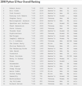
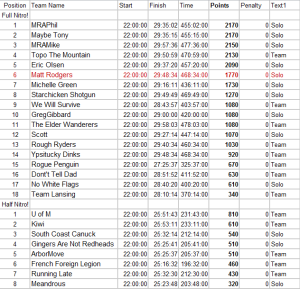
Over the weekend of June 18-19, I took part in my second rogaine of the year (fifth total) – the Nitrogaine II up near Ann Arbour, MI. This was an 8-hour overnight event starting at 10pm on the 18th and finishing at 6am on the 19th.
This definitely had a higher flag density than any rogaine I’ve done previously, which was lots of fun (53 total controls for an 8 hour event…of which I ultimately found 30). The electronic scoring system was also nice. The relatively flat topography and nighttime conditions made navigation relatively challenging, but this was offset somewhat by reflective tape on the controls, and even some tags of reflective tape marking a small perimeter around most controls.
Maps were distributed at 8pm, and I spent most of the next two hours planning my route, coming up with a few contingency plans, and getting my gear together.

20 minutes before the start
I was trying out a brand new pack (the Salomon Peak 20) that I’d ordered online with a gift card, and ended up being very happy with it. It’s smaller than my Mountain Hardwear Fluid 26 that I use for long hikes, but larger than my Nathan running vest or Osprey Raptor 10. It’s lightweight and built more like a vest than a backpack, so it doesn’t interfere with running. It’s really designed perfectly for medium length adventure races and rogaines.
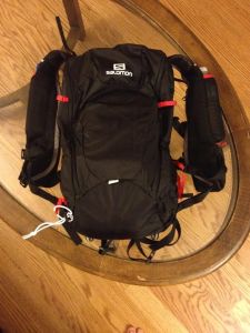
Salomon Peak 20
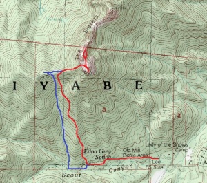
From the start/finish area in the southeast corner, the course map seemed to present two obvious options – a “northern route” and a “western route” – with plenty of variability and decision-making involved with each. I opted for the western route, then added a few additional controls further north on my return trip. On the map below, you can see my “pre-race” route plan in faint blue (which I mostly stuck to), a few bailout options I’d outlined in faint red, and my actual route superimposed with red sharpie.
click to enlarge
When the race started, I headed for control #74 along with three or four other people. I then began snaking my way in a southward direction, hitting controls #32, #86, #48, #31, #43, and #51. As with most rogaines I’ve done in the past, the highest density of controls seemed to be within a few kilometers of the start/finish area. I wanted to hit as many of these as possible early on to take advantage of all the points…but I also wanted to leave a few behind to give myself some flexibility for the tail end of the race.
Silver Lake, sunset
I found all of these initial controls without difficulty. The undergrowth was relatively thin and run-able in this area of the map, and I was making better time than I’d anticipated. From #51, I made my way west to #96, then continued west until hitting a trail. Following the trail, I snagged #36 (underneath a footbridge) and #84 (near the tip of a peninsula). The only control I left behind in this southeast corner of the map was #56, since it would have involved some backtracking. In hindsight, though, it probably would have been worth the 10-minute round trip after leaving #96. A minor tactical error.
I made a much more serious mistake, though, going for #42. I easily wasted 15-20 minutes on this low-value control, initially missing it to the south, then doubling back and overshooting to the north, then wandering directly INTO the marsh it was positioned next to. I was on the verge of calling this one a lost cause, when another team “rescued” me. I was able to make it out of the marsh by heading toward their headlamps, and the three of us stumbled into #42 shortly thereafter.
After that mishap, I continued west to #75 (along a spur), #30 (just off the trail), and #44 (also just off the trail). I bypassed #67 since it was slightly out of the way…but again, in hindsight, it would have been a good idea to grab. The route was almost entirely on trail.
#80 was a little further off-trail (following the theme of high-value controls being tougher to find), but I had no trouble there.
After this, though, I made 3 mistakes in the span of 30 minutes. First, I managed to miss #77 completely. This was by far the “flattest” rogaine I’d ever done, and my skills weren’t quite up to the challenge of discerning some of the more subtle land features on the course – particularly at night. Being a novice, I generally like to rely more heavily on topography than my compass. When I found myself standing in the forest with no idea if I was north/south/east/west of the control, I bailed south back to the trail and continued to #88.
One of the trails – taken just before sunrise at the end of the race
On the way I made my second mistake. While jogging through the thick undergrowth (and glancing distractedly at my map), I snagged my foot on a fallen log hiding under the greenery. I face-planted hard. Completely knocked the wind out of me. This should have been a warning, but…
…two minutes later, I made the third mistake. I was only a hundred meters or so from #68 and trying to move too fast through some dense deadfall. I turned to look over my shoulder…turned back around…and took a stick to my right eye. When I reached up, the stick was still protruding 3-4 inches out of my eye. For a few seconds, I legitimately thought I had an open globe. Fortunately it was just lodged between my cornea and upper eyelid. So I got away with just a corneal abrasion, which hurt like a beast for the next few days.
Now with only one good eye, my pace slowed down considerably. This may have actually helped me making the loop from #68 to #88 to #104. The lack of trails in this section made route-finding more important, but now I was taking more time to fine-tune my route rather than navigating on the run. I ever-so-slightly overshot #104, but otherwise had no issues. Talking with others after the race, it sounded like #88 had given a few people problems.
The undergrowth was horrendous to the northeast of #104. After crashing through a few spider webs and slicing myself up on some briars, I finally stumbled back to the trail and made a second attempt at #77. This time I hit it dead on. Maybe this one eye thing isn’t so bad!
I continued west to #60, located near a copse in a large field of waist-high grass. I took advantage of the nearby water station to refill, then took a couple minutes to debate going for #102.
It felt wrong not to go for such a high-value control when I was already so close. But on the other hand, I wasn’t too excited about an extended off-trail out-and-back venture in my semi-impaired state. I decided to skip it and head for #47, which was probably dumb from a points standpoint. In the end, though, nobody finished <100 points ahead of me, so skipping #102 didn’t cause me to drop in the standings.
#47 was located a short distance off the road, near the top of a gully. I continued making good time on roads and trails toward #66, #73, and #69. These were all in close proximity to trails, so each only required ~5 minutes of bushwhacking.
When I hit the road north of #69, I had another decision to make. I thought briefly about taking a southern route toward a cluster of low-value controls (#41, #65, #34, #49, #33) with the option of picking up some high-value ones time permitting (#82, #70, #94). Instead I continued north toward the #63-#90-#71 loop. This was probably my biggest tactical error of the night.
I missed my intended turnoff for #63 and had to backtrack, costing me a few valuable minutes. I only overshot #90 by 30 meters or so, but the surrounding forest was packed with the densest brier patches I encountered all night. I lost another ten minutes or so flailing around and getting some nice gashes on my forearms and bald head.
When I regained the road south of #90, I immediately began hiking briskly eastward. I knew I had to make a decision about #71, and wanted to save time by doing it on the move. I had about 1 hour 40 minutes remaining, but the finish area was still several miles away. The route to #71 didn’t look terribly long or strenuous, but the lack of clear landmarks from the road (approaching from the east) made me worry I’d waste time hunting around in the dark (or stuck in another marsh). I decided instead to continue moving southeast, using the remaining time to pick off as many controls as possible nearer to the finish area.
So the loop northward to #63 and #90 probably wasn’t ultimately time well spent…but I still think I made the right call by skipping #71.
I detoured off the road to successfully bag #94 – a task made easier by a fork in the road to the north (good landmark) and some helpful topography. I then continued southeast to #52 (located about 100 meters off the trail, down a hill and next to a marsh), then to #58 (along a spur on the edge of a lake), and #38 (in a small depression). I had been a little nervous about making it back on time (there was a harsh 100 point penalty per 1 minute late), so I was running hard for the final 3 controls. I hated not going for #76, but the risk of missing the 6am deadline scared me off.
I made it back to the finish area with 11 minutes 26 seconds to spare…just as it was getting light enough to turn off my headlamp.
Silver Lake, sunrise
Here’s the breakdown by time:
Start – 2200
#74 – 2207
#32 – 2213
#86 – 2220
#48 – 2226
#31 – 2235
#43 – 2239
#51 – 2245
#96 – 2251
#36 – 2259
#84 – 2310
#42 – 2333 (after getting lost)
#75 – 2353
#37 – 2358
#44 – 0011
#80 – 0024
#68 – 0104 (after missing #77 and scratching my cornea)
#88 – 0111
#104 – 0132
#77 – 0154
#60 – 0224
#47 – 0249
#66 – 0303
#73 – 0320
#69 – 0329
#63 – 0353
#90 – 0411
#94 – 0506
#52 – 0524
#58 – 0532
#38 – 0538
Finish – 0548
And here are the results. I finished 6th out of 18 in the eight hour division.
Tomorrow is my first day of residency (and my birthday) and I still have a few things to get ready, so this post will be hasty.
My route: ascent in red, descent in blue
Trent was still having a lot of ankle pain, so he stayed back to explore the Las Vegas Strip while I drove up to the Spring Mountains for a short solo ascent of South Sister (approx 10,150′) and Middle Sister (10,197′).
South Sister from the parking area
Middle Sister (left) and South Sister (right) from ridge to the west
After finding a parking spot, I loaded my pack and hiked west for about a kilometer before leaving the trail and heading up the gradual, wooded slope. I continued uphill (north) for about another kilometer, angling slightly west along the way, up and over a small ridge before following a reentrant up to the larger ridge just west of the peaks.
Charleston Peak (left) from the top of South Sister
From the ridge, it was easy class 2 up loose scree to reach the South Sister. I then headed back down into a small valley before climbing Middle Sister. This required one short class 3 climb – a 20 foot chimney with plenty of solid handholds.

Class 3 chimney
From the top of the chimney, a fun little knife edge continued another 100 feet or so to the true summit. It was plenty wide, without much exposure, but offered sweeping views of the surrounding peaks.
Knife Edge on Middle Sister, with Macks Peak visible far left and North Sister visible far right
More knife edge north of the summit
The knife edge continued north of the true summit, and I followed it for another couple hundred feet before the exposure forced me to double back. I was entertaining thoughts of going for North Sister off in the distance, so I climbed back down the chimney and started sidesloping along the eastern side of Middle Sister. That lasted about 10 minutes before the terrain became too steep and I was once again forced to double back. I’m confident the route would have been straightforward had I taken a more conservative route, but after my two failed attempts at short-cutting I decided to head back to the car.
Cliffs on Middle Sister
About where I turned back, after trying to shortcut around the east side of Middle Sister; you can see North Sister in the distance
On the way back down, I hit a high point (~9750′) on the ridge to get a few more pictures. I then followed the reentrant all the way back down to the trail (blue line on the map above…which turned out to be the simpler and easier route, for future reference).
Another view of Charleston Peak, from near the high point
The round trip took a little under 3 hours. It was still mid-afternoon, so Trent and I did some more exploring in Vegas before catching our overnight flight back to Milwaukee. I also turned $12.00 into $22.50 playing roulette, which basically paid for gas & parking for this hike. Probably the first and last time I gamble, so I can now retire a winner.
For day 6 of the trip (6/2/16), Trent and I drove to Capitol Reef NP after sleeping in following our night hike. Trent’s foot was much more sore, so he decided to sit things out for the day.
My original plan was to climb George BM from the Golden Throne trailhead (about 2 miles of trail followed by 2+ miles of off-trail navigating to the summit), and I actually ended up hiking about 200 yards up the trail before stopping and changing my mind.
I felt a little bad about letting Trent roast down by the car for 4-5 hours, and the late start meant we were already in for a late night heading back to Las Vegas.
Fern’s Nipple from the road
View from the west side of the national park
So instead, we drove a few miles back up Capitol Reef’s Scenic Drive and parked at the Cassidy Arch trailhead. My plan B was to climb Fern’s Nipple (7,067′) – one of the park’s classic off-trail scrambles. The distance was a little shorter than George BM, so I didn’t figure I’d be gone as long. I had a good topographical map of the area, but unfortunately hadn’t read up on this route very well. This would come back to burn me. Some of the notes below are for my own sake, in case I ever make it out to try this again.
My route in red (including some obvious attempts at routefinding), true route in blue (as best I can tell), crux of the route is the purple dot, photo of turnoff for the true route (see below) taken from yellow dot
I started by hiking a short distance northeast up the canyon, looking for the cairned turnoff on my right. After finding this without any trouble, I followed a faint use trail southwest (gaining a few hundred feet in the process) until reaching the entrance to Bear Canyon.
Ledges leading into Bear Canyon; go straight then turn left. Parking area visible off to the right.
In order to enter Bear Canyon, you’re required to round a corner by traversing a narrow (maybe 12-14 inch wide) rock ledge. There’s quite a bit of exposure – a fall would almost certainly be be fatal here – but numerous good handholds on the sandstone to your left. This is the spot I marked with a purple dot on the map above. I recommend doing this section standing, facing the wall.
Looking back at the fixed rope, from just inside Bear Canyon
Immediately after rounding the corner, you’ll find a fixed rope (assuming it’s still there) aiding a 20ish foot vertical drop onto a larger ledge below. I didn’t have any climbing gear with me, so it was fortunate someone had left the rope (thanks!).
Looking back at the entrance to Bear Canyon; route in red
Things got easier from here, as I followed the only obvious way forward across Bear Canyon and gradually up the other side. Shortly thereafter the route turned southward again before entering another small side canyon. I’m not positive, but I’m about 95% sure this is where I went off-route. The picture below was taken from the yellow dot on the map above, looking south. You can see my route in red. In hindsight, I think I should have moved higher up the band of cliffs at this point. I outlined a couple possibilities in blue. The higher of the two is probably a better bet, assuming it’s accessible.
Possible ways forward; Fern’s Nipple visible in the distance
I continued forward oblivious, not realizing I hadn’t gone high enough up the canyon wall. I would end up spending the next 80-90 minutes searching for a way forward, which you can see as dead ends on the map. One spot in particular looked very promising from a distance, and I free climbed a few (small) cliffs to get there…only to find myself standing at the base of a 15-foot, smooth, vertical sandstone wall. Not climbable for someone like me.
View to the north
I eventually decided to head back. I spotted the promising blue route (above) on my way back…and under different circumstances probably would have gone for it. But it was getting late in the day, Trent was probably getting bored back at the car, and the hot sun (mid/high 90’s) was starting to sap my energy.
Cassidy Arch in the distance
On the way back, I spotted Cassidy arch on the other side of the canyon. Allison and I had hiked to the top of it a little over five years ago (read the blog post here). I managed to haul myself up and out of Bear Canyon with the aid of the rope – a little easier now that I was carrying a couple liters less water.
After making it back to the car, Trent and I made the long drive back to the Excalibur in Las Vegas (stopping by a good Mexican restaurant in Richfield on the way).
6/1/16 turned out to be a full day. To recap, we spent the morning driving 170 miles from Richfield to Moab. Then we spent the afternoon mountain biking, and had dinner. Then we drove another 100 miles to Goblin Valley State Park. Then we drove another 7 or 8 miles to the trailhead for Little Wild Horse and Bell Canyons, arriving shortly after sunset.
Hiking toward the canyons
Together, the two canyons can be connected via an 8-mile loop. Since it was already getting dark, we left the car with the intention of checking out part of Little Wild Horse (a popular slot canyon) and coming straight back. Maybe 1 or 2 miles round trip. Somewhere along the way, though, we decided to just do the whole thing. Why not.
We didn’t have a map, and Trent had a badly sprained ankle…but we did have headlamps, water, and ibuprofen.
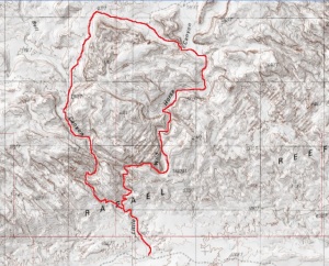
The route (we went counter-clockwise)
By the time we reached the slot portion of the canyon, it was almost completely dark.

Little Wild Horse slot canyon
It would have been pretty cool to see during the day. In the dark, it almost felt like we were back in Indiana spelunking. Except with a really impressive night sky.
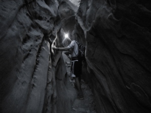
Entering the slot canyon
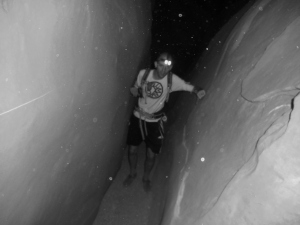
More slot canyon
The slot portion of the canyon was impressively long. Maybe 1.0-1.5 miles I would guess.
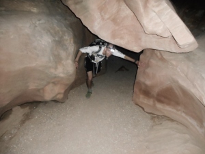
Ducking under a chockstone
After a while the canyon widened out, and we were walking through a dry stream bed. I knew we’d eventually need to make a left turn in order to meet back up with Bell Canyon, but without a map we had no idea when/where that turnoff would be. We hoped it would be obvious enough when we saw it.
I could also make out plenty of footprints in the sand with my headlamp. I figured if the footprints disappeared, we’d know that we’d gone too far up the canyon.
And we got lucky. We nearly walked right past the turnoff in the dark. As you can see, it would have been impossible to miss in broad daylight.
TURN LEFT
The return trip wasn’t quite as impressive. Bell canyon had a few narrow sections and short downclimbs, but by this point we were both kind of sleepy. We made it back to the car around midnight, found a spot to pull off the road, and slept in the next morning.
Bell Canyon
Recap: 2018 start, 0003 finish
This will be a short post, since we honestly didn’t do much hiking here. We made it down to Goblin Valley shortly before sunset on 6/1/16, just in time to explore some of the formations before dark.
Overall a very cool place.
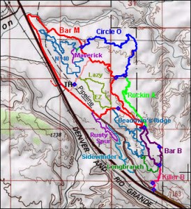
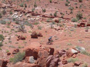
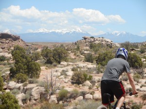
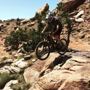
On 6/1/16, Trent and I rented a couple mountain bikes and spent the afternoon on the Moab Brand trails just outside of Arches National Park. We rode all or part of the Bar M loop, Lazy-EZ loop, North 40, and Sidewinder. Sidewinder was probably our favorite. Fast and downhill. North 40 was also good, though it was slower and more technical.
Moab Brand Trails
I hadn’t ridden on mountain bike trails in 5-6 years, so it took me a half hour or so to get the hang of things.
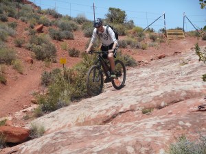
Me on the Sidewinder
We also got a little lucky with the weather. Highs in the low 90’s, but the forecast was calling for upper 90’s and 100’s over the following days.
Trent on the Sidewinder
Trent on the North 40
Trent is definitely the better mountain biker. I got a few pictures and videos of him doing jumps, although he did sprain an ankle pretty badly on one of the landings.
One of the jumps
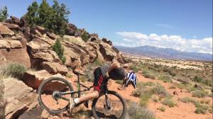
Here’s the ankle injury
After returning the bikes, we hit up one of the local brew pubs for some fish & chips (10/10 would go again) then drove down to Goblin Valley State Park for the evening. I’ll add those pictures to the next post.
After picking Trent up at the Las Vegas airport, my plan had been for us to attempt South Guardian Angel on 5/31/16. This was probably my most anticipated climb of the trip, but unfortunately it fell through for a variety of reasons.
We had a few minor delays in Vegas, and didn’t make it to Utah until later than expected. On top of that, I had forgotten to account for the time change from Pacific to Mountain time. In order to have a chance at South Guardian Angel, I knew we’d need to get a very early start…so we were only looking at getting about 3 hours of sleep. I was still fighting off an infection and feeling a little worn down after 3 days of hiking and climbing, and my brother was exhausted coming off a 24 hour EMS shift followed by a full day of travelling.
So we decided to sleep in until 0830 the next day and take things easy. SGA will have to stay on the bucket list for now.
I came up with Plan B on the fly. I’d been to Zion twice before, but never hiked its most famous trail to Angel’s Landing (5,785′).
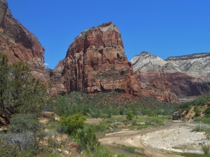
Angel’s Landing, from below
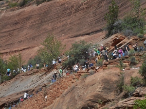
After making the drive to Zion, we caught a shuttle to the trailhead and started the hike. I knew this was a popular hike, but we weren’t quite prepared for just how popular it was. There were hundreds of people up there, and we could only move as fast as the slowest person (not much room for passing).
It brought back memories of Disney World
The final 1/2 mile to the top took us about an hour, as we waited in line for everyone to make their way across the ledges.
The final stretch
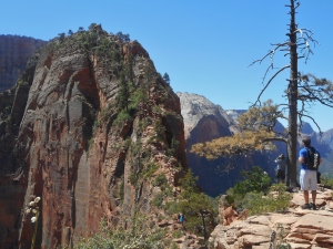
I’m really not complaining though. It was a unique trail with awesome views. It just might need a permit system at some point to keep the crowds under control.
Crossing some ledges
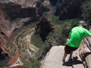
View from the top
After finishing, we caught the shuttle back to our car around 1345. Since there was still plenty of daylight left, I wanted to show Trent another cool spot I’d discovered when I’d visited Zion six months earlier. We exited the park, drove back to Virgin, Utah, then followed the Kolob Rd north. We pulled off the road a couple miles before the Wildcat trailhead (where we had originally planned to depart for the South Guardian Angel climb), and I led the way to the top of Cave Knoll (6,495′).
On the way to Cave Knoll (South Guardian Angel in the background)
The off-trail scramble to the top of Cave Knoll is probably the best 3 hour bang-for-your-buck hike in all of Zion. (Technically the bang-for-your-buck is infinite, since it’s in a no-fee area.) And the best part is that nobody seems to know about it. I’ve climbed it twice now, and neither time did I come across so much as a human footprint.
Stopping for a break
I mentioned that the route is off-trail. The distance is minimal and the navigation is pretty straightforward, but there is one minor “trick” involved. It’s described elsewhere online. If you don’t know it, you might run into some unnecessary pain and frustration. I decided not to mention it here, only because half the charm of this place is the relative solitude.
Heading toward the top of the knoll
Most of the route can be walked, but there are a few short/easy class 3 sections.
Standing on the “summit”
Hiking through the maze of sandstone
Red Butte in the distance
After making it back to the car, we drove a few more hours to the hotel we’d booked for the night in Richfield, Utah.
For my third day in California (5/30/16), I woke up around 0445 to make the drive to the Telescope Peak trailhead in Death Valley NP. Telescope Peak (11,049′) is the highest point in Death Valley, and towers over Badwater Basin (-282′), the lowest point in North America. So despite being about 3000 feet shorter than Colorado’s 14ers (in absolute terms), Telescope actually has about twice the base-to-summit height.
I didn’t start from Badwater, however. I took the much shorter route from Mahogany Flat campground – roughly 14 miles round-trip with 3300′ of gain.
Charcoal Kilns, just before the 4WD road
The final 1.5 miles of road is rough gravel. A sign recommends high-clearance 4WD vehicles only. For what it’s worth, I made it up in my compact car with no issues. Passenger cars that park below this 4WD road would be looking at a 17 mile round-trip hike with ~4,000′ of gain.
The hike itself was 90+% on-trail. (I only went off-trail briefly to climb Bennett and Rogers Peaks on my return trip. Each can be done as a 20-30 minute detour by heading up the scree slopes.)

Nothing about the hike was particularly challenging, but the views were fantastic. I only stopped a couple times on the way up, and reached the summit of Telescope in 2 hours 31 minutes.
Looking down into Badwater Basin from the slopes of Telescope Peak
I saw maybe 10-12 other people over the course of the day, most of them guys about my age solo-hiking.
Telescope Peak summit register
The day was a little hazy, but I could still make out the Sierras in the distance to the west (the faint white line on the horizon in the picture above), and the Spring Mountain Range near Las Vegas to the east.
Summit of Bennett Peak, looking back toward Telescope Peak
My return trip actually took longer than the initial climb, mostly because of the detours to climb Bennett Peak (9,980′) and Rogers Peak (9,994′).
Summit of Rogers Peak
Radio station atop Rogers Peak
After making it back to the car, I made the long drive back to Las Vegas to pick up my brother from the airport that evening. More to come.
Recap: 0725 start, 0956 summit of Telescope, 1252 finish
Day 2 of the trip also involved a last-minute change of plans. I drove south from Bishop, Ca to Independence, Ca, and from there to the Onion Valley trailhead. I loaded up my pack and set off up the Robinson Lake trail around 0740, with the intention of climbing University and/or Independence peaks.
I knew to expect snow, but I also knew there was a chance the snow would be too much to manage without snowshoes. So I had a low threshold for bailing out. About 20 minutes up the trail, I was able to gain a viewpoint of the lower slopes of Independence peak and didn’t like what I saw. Since it was still early in the day, I turned around and headed back to the car.
Parked at the base of Kearsarge Peak, with Onion Valley in the background
I had already prepared a backup plan (Mt. Inyo and Keynot Peak, a short drive to the south). However, as I descended back into Onion Valley, the pyramid-shaped Kearsarge Peak (12,598′) could be seen almost entirely free of snow (despite being significantly higher than Independence Peak at 11,744′). Since I was already here, and since my pre-printed maps already included Kearsarge, I decided to go for it.
My route (ascent in red, descent in blue)
The USGS maps of the area depict a trail going from the southeast most of the way to the summit. As it turns out, no such trail exists. I did find a few cairns and short sections of what might have previously been a trail about 3/4 the way to the top, but that’s it.
Looking across the valley toward Independence Peak (left) and University Peak (right)
From the car, I headed up a large wash on the southeast side of the mountain. The route started off brushy, but quickly transitioned to loose, rotten scree. I’ll be honest, it was not a pleasant climb. As soon as it became feasible I headed further north onto a ridge to avoid the worst of the loose stuff, and the footing became marginally better after that.
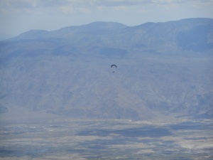
Someone paragliding over the Owens Valley
The climb was a pretty mindless class 2 walk-up. I did spot the remnants of an old mining camp on one of the ridges, but didn’t take the time to check it out.
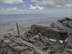
Makeshift shelter near the summit
There was still a fair amount of snow along the summit ridge, but it was almost entirely avoidable.
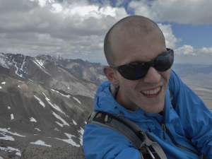
Summit selfie
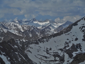
View to the west, into the Sierras
University Peak to the southwest
The return trip was more enjoyable than the initial climb. A good mix of downhill hiking and scree-skiing on the looser terrain.
I planned to check out Death Valley the following day, so after making it back to the car I continued driving south to Ridgecrest (passing Mt. Whitney, the highest point in the lower 48, on the way).
Kearsarge Peak (view from the town of Independence)
Mt. Whitney (view from the town of Lone Pine)
Recap: 0840 start, 1202 summit, 1402 finish
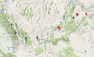
I just flew back to Milwaukee this morning (June 4) following a week of hiking, climbing, and mountain biking out in California, Utah, and Nevada. There’s probably enough material for seven or eight blog posts, which I’ll be posting over the next couple weeks. The map below outlines where we were (blue for stuff I did solo; red for stuff I did with my brother Trent, who few into Las Vegas a few days after me).
I made the flight from Milwaukee to Las Vegas on the evening of May 27, arriving around 2130 that night. My initial plan had been to drive overnight to central Nevada to climb Currant Mountain and Duckwater Peak the following day, but a few developments caused me to change plans at the last minute. I’d called a local ranger station earlier in the day, and learned that there was ~150% usual snowpack in the area…so I would be looking at a very long and challenging day, with lots of snow and ice, on very little sleep…and on top of it all, I had just picked up a nasty respiratory infection. (One week later and I’m still coughing up green junk.)
I decided instead to go for something shorter and less remote – Mt. Morrison (12,268′), nicknamed the “Eiger of the Sierra”. I departed Las Vegas in my rental car a little after midnight, and drove directly to the Convict Lake trailhead near Bishop, California. The drive was pleasant, with lots of coffee and podcasts to keep me awake. I arrived around 0515 in the morning and began hiking at 0540.
Early morning light on Mt. Morrison, seen from the road
Based on my research, I knew the mountain could be climbed from several different approaches. I opted for a loop route (seen below).
ascent in red; descent in blue
I began by heading southwest along the shore of Convict Lake, then began my climb from the north.
View across Convict Lake (Mt. Morrison off-screen to the left)
The initial part of the climb was a straightforward uphill slog, taking me under the towering cliffs north of the summit. I found myself slightly more winded than usual (thanks to illness, lack of sleep, and no time to acclimate to the elevation) but I kept a reasonably good pace nonetheless.
Looking up toward the summit
It wasn’t long before things got more interesting. Starting from the base of these cliffs, most of my route was still snowed in. I had brought along my ice ax, but in hindsight some crampons would have been nice as well. The snowfield was still solid as rock at this point, but would become progressively mushier as the day went on.
Snowpack leading up to the pass
Looking back down
View of the cliffs, from halfway up the snowfield
Things got a little spicy when I reached the pass, directly east of the summit. From my angle, it was impossible to see what kind of drop-off awaited me on the other side. More specifically, I had no way of knowing whether I was climbing up onto a solid ridge, or up onto an exposed cornice. And to make matters worse, the morning sun was now beating directly on the area in question. Potentially a deadly combination.
I decided instead to climb directly onto the ridge higher up and to my right. This was steeper and slightly more challenging, but put me up on solid rock and safely away from (what turned out to be) a cornice. I was now faced with yet another detour, as the route upward from here required some semi-exposed snow climbing that I wasn’t comfortable attempting in running shoes. So I cut further southward, dropped below the aforementioned cornice, glissaded a few hundred feet down the mountain’s east face, then continued south across another snowfield toward more gentle terrain.
View up the (more gradual) east face
I climbed up to the summit ridge using the scree and talus to the right of the snowfield pictured above. There was one more unavoidable patch of deep snow near the top, maybe 150 yards long, which by now was soft enough that it required postholing up to the hips. I made the summit ridge at 1100.
View along the summit ridge, looking south
For the descent, I headed directly down the east face before continuing my loop around Mono Jim Ridge toward Convict Lake. I was able to glissade several hundred vertical feet, which sped things up some, but I did lose time picking my way through some cliff bands lower down.
It’s possible to keep those cliffs class 2-class 3 with patience and good route selection
The last couple miles was a very gradual cross-country hike down to my car. I was going on 30 hours without sleep at this point, so despite the easy terrain this felt like the longest section of the day. A storm also moved in around this time, and I was completely drenched. I made it back to the car at 1355, drove back to Bishop for some much needed McDonalds, then slept in the car for 13 straight hours.
Last weekend I met my buddy Philip down in the mountains of Virginia for a 24 hour rogaine.
Start/Finish area
It was a long drive from Milwaukee, but I made it in Friday evening and got a decent night’s sleep in the back of the Honda Fit.
Maps were handed out at 0700, and teams were allowed to start any time between 0800 and 1000. Our goal was to start right at 0800, since Phil had a flight to catch out of DC on Sunday afternoon and needed to be back early.
After some deliberation, we decided to concentrate mostly on the southern half of the map, where the points seemed to be concentrated a little more heavily.
We started by heading southeast to #32, which we found without any difficulty. Since Phil had never done a rogaine before, I was in charge of the navigation…and probably made a poor impression by immediately screwing up on the second control. I didn’t look closely at the map when leaving #32 and inadvertently took us up the wrong spur, overshooting #43 and forcing us to double back. We probably lost 20-25 minutes all told.
From there, we dropped back down to the stream, followed it up to #62, then climbed up to an old road where we made much faster time.
On the road, after bagging #62
We moved pretty quickly up and down the hills during the first few hours. I worked up a good sweat despite the cool weather. We quickly grabbed #52 – only 100 feet or so off the trail – then bushwhacked our way down to #42. Again, we found this one without any issues.
It had been 18 months or so since my last rogaine, but at this point I was starting to feel more confident in my navigation. So confident, in fact, that I somehow took us directly past #33. We figured out pretty quickly that we’d missed it, but opted not to double back since it was only worth 3 points. So we continued uphill until we ran into the Lookout Mountain trail.
We’d been working off a rough outline that we’d put together before starting, but at this point we called our first audible. Rather than continuing south and west, I took us north to grab #61. (I had initially been “saving” this control for our return trip, but now felt that it was too close to pass up. This ended up working out well, since our return trip ultimately brought us back to camp via the road, rather than hitting the 61-51-41-31 combo I had been planning).
We made it to #61 a little over two hours after starting. We’d been pushing things a little hard following our early mishap, so we took advantage of the well-marked trail toward #85 to slow the pace, re-hydrate, and have a few snacks. After the long climb up to #85, we stopped for a short break before heading down to #98.
Descending Lookout Mountain, northwest of #85
Here we had another small navigational mishap. I took us a little too far north while descending the spur, and soon realized we had probably missed #98. Unfortunately, without an altimeter, I couldn’t be sure how far we’d descended…and of course the hillside was densely overgrown. It made for poor visibility and slow going. Ended up taking us a little over an hour to make the ~800 meter trip from #85 to #98, but we did eventually find it.
The navigational side of things went much more smoothly after this. We descended the reentrant from #98 directly to #72, then waded across the North River to meet up with a trail. We then followed this southwest to another ford, where we backtracked a short ways up the river bank, climbed a steep embankment along the side of some cliffs, and followed another reentrant up to #64.
Control #72, near a creek feeding into the river
Control #64
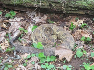
The trek from #64 to #84 was mostly uneventful, with one major exception. Immediately after crossing the river, as I was looking down at the map and compass while walking, I noticed a flash of movement out of the corner of my eye. Then I heard a THUMP followed by a sharp rattling sound, and reflexively jumped backwards. Turns out I had just been struck at by a very large rattlesnake. It miraculously didn’t break skin, for which I can probably credit my hard-shell pants.
We pressed on to #84, then took another short break to reevaluate our plan. There were several high-value controls in the area, but we still needed to decide which ones to target, and in what order. After a few minutes, I decided to take us to #73, #94, and #81. It was a tough call skipping #92 (and in hindsight, it would have been worth making a detour for). The trip to #73 was straightforward from a navigational standpoint – directly south at the same elevation – but it involved nearly a kilometer of awkward side-stepping along a steep slope. Rough on the ankles, and slippery in places due to the near-constant light rain throughout the day.
The trip from #73 to #94 was a bit of a navigational challenge, with control #94 tucked away in one of several nearly-identical reentrants. I led us northwest through the forest, trying as carefully as possible to minimize our net elevation gain. I knew the destination was ~ 180 feet above us, and wanted to avoid confusion by intentionally approaching it from below. (The worst feeling, of course, is when you can’t tell if you missed a control too high or too low.) I also left Philip in charge of counting aloud each reentrant that we crossed, to help track exactly where we were. We found #94 without any mishaps, then backtracked downstream a short ways to filter some water and eat a snack. From there it was a short climb up to #81, followed by an easy descent back down to the main trail and then out to the road.
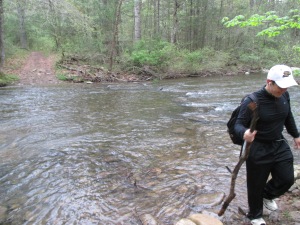
Another river crossing on our way back to the road
Our next destination after reaching the road was #83. A long and steep climb, but we made relatively quick work of it. We then backtracked to the road and followed it northwest toward an intersection. Before reaching it, we turned off the road to our right to bag #96. I initially took us up the wrong reentrant, but we immediately caught the mistake and corrected course…maybe costing us 3-4 minutes of lost time.
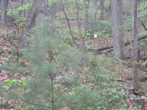
Control #96
We were running out of daylight at this point, and the rain was starting to pick up again. We made quick work of #88, then continued north, followed the ridge to the highest point of the hill, and hit #55 and #45 on our way back down to the road. We were forced to bring out the headlamps just before reaching the road.
We followed the road east for 50 minutes or so. It was around this time that we agreed to head back toward the finish area, grabbing a handful of controls on the way. As I mentioned, Philip had a flight to catch the next day and wanted to get some sleep. We aimed to be back around 0200 (~6 hours early). There were a number of controls within striking distance that WOULD have been attractive targets had we had the time (46, 66, 95, 35, 78, 63, 71, 54, 34, 91, 87, 51, 41, and 31). Instead we just went after the low-hanging fruit (i.e. close to trails and roads, and/or near easily recognizable geographic features).
Our first stop was #46 – a low point value control, but attractive because of its close proximity to a side trail. Only a few of the controls had reflective tape, incidentally, and this turned out to be one of them. We found it without difficulty, and continued making our way eastward toward #35.

Control #46
Without light, we had to rely heavily on my compass for navigation. A slight curve in the road was our cue to head south, and I led us up another steep, soggy, thickly overgrown embankment. I wish I could say it was skill rather than luck…but either way, I led us directly to #35. No reflective tape, but we didn’t need it. We then followed the ridgeline eastward to #63. This took us almost 40 minutes (despite the short distance) thanks to the heavy undergrowth. We got stabbed by plenty of thorns, and almost walked into another large snake. Luckily I caught the reflection of its eyes with my headlamp, about 10 feet away, and we were able to give it a wide berth. After finding #63, we headed north again, waded across another river, and bagged #54.
Wading across another river
This required an extra kilometer or so of hiking in order to get above some large cliffs…but fortunately it was all on trail. Control #54 was found easily and we continued north back to the road. I tried convincing Phil to chase after a few more controls, but no such luck. We followed the road back toward the finish area, and I made another blunder by missing #31 right at the entrance to the campground. A number-less control had been left there to direct cars to the correct turnoff, and I mistakenly thought this must be #31 (my fatigued brain assumed the number-punch must have fallen off). Oops. I learned later that the REAL #31 was a short distance away, closer to the river. I did successfully track down #41 near the edge of the campground, then we called it a night. It was 0145 when we arrived back at the campground. Soaked and shivering. We each caught a few hours of sleep in our respective cars, then turned in our score card and grabbed some breakfast and coffee.
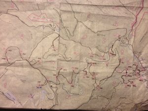
Our route, with corresponding times
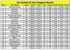
Our goal before starting had been to place in the top half, and we (barely) did so. We finished 10th out of 21 in the 24 hour division, with 24 controls and a total score of 146.
Overall this was an excellent event. Definitely hoping to do it again next year.
Last winter (early January 2015) I had planned a 27.5 mile hike in the Smoky Mountains with some friends. Our plans fell through, though, when I came down with the flu a couple days before we were planning to leave. So this year my brother and I decided to make it happen over the holiday break.
We left Newburgh at 3:15 am on December 31, 2015. We had agreed that I would make the 6.5 hour drive down while he slept, then he would make the 6.5 hour drive back home while I slept. The entire trip ended up taking 27 hours, and we didn’t have to drop any money on a hotel. Or bring camping gear.
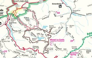
Our route (in brown)
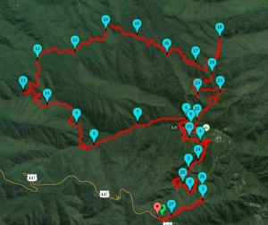
Satellite View
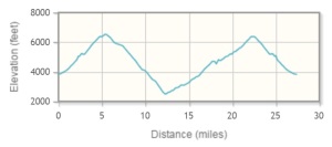
We departed from the (very popular) Alum Cave Trailhead. There were a lot more people on the trail than I expected in late December…probably due to the NYE holiday and the nice weather (high around 50 in Gatlinburg and mid- to upper- 30’s at the top of Le Conte). We probably saw 60-80 people on the way up via Alum Cave, compared with 0 people on the way down Bullhead, 4 people on the way back up Trillium Gap, and 2 people going back down Alum Cave later that night.
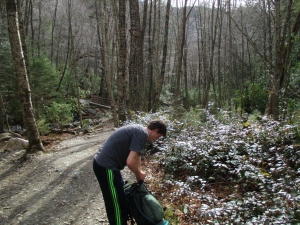
Starting up the Alum Cave Trail
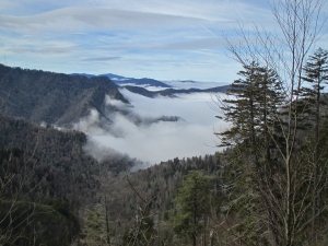
Dense fog down in the valleys
Trent and I got a chuckle out of one of the guys we passed on the way up – a heavy-set man in his 40’s or 50’s. He must have been offended when we passed him, because he practically ran past us a few seconds later, shot us a dirty look, then power-hiked in front of us for a few minutes before eventually having to pull over to catch his breath.
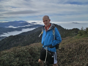
Standing atop Mt. Le Conte (6,594′)
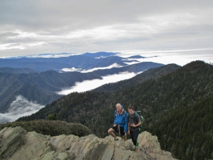
Broskis
We made good time descending via Bullhead. The trail was pretty smooth and gradual, and the lack of leaves on the trees made for excellent views of the valleys below.
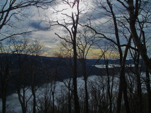
Descending into the fog…
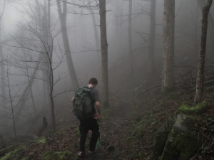
…very thick fog
The transition into the fog was very sudden, and visibility dropped to just a few feet in some places. We’d end up walking through the fog until after nightfall, including the last 1.5 miles or so of Bullhead, and the initial section of Trillium Gap until we were a little past Grotto Falls.
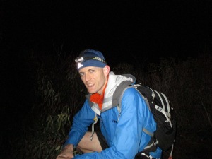
Brushy Mountain summit (4,911′)
It was completely dark by the time we made it to the top of Brushy Mountain, but we were once again above the fog. So we took a few pictures and had a snack before continuing the rest of the way to Le Conte. We were pretty footsore at this point, and low on food…so the final 3.5 miles up the Trillium Gap trail was the toughest section of the day. We had been talking most of the day (politics, jokes, medical stuff, etc.), but switched to headphones and focused silence for this section.
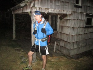
Mt. Le Conte summit, for the second time
It was very chilly at this point (probably low- to mid- 20’s), but didn’t feel bad at all so long as we were moving. Trent and I had been prepared for the worst, and each had a couple extra layers in our packs that we never ended up using.
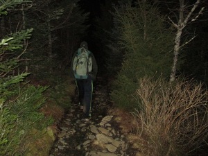
Heading back down the Alum Cave Trail
The final 5-mile descent on the Alum Cave Trail felt relatively easy. We chatted briefly with a couple guys heading to the summit to spend the night, but otherwise didn’t see anyone. Made it back to the car at exactly 11:58 pm EST on December 31, 2015, just BARELY in time to keep this from turning into a 2-year-long hike.
2 minutes until 2016
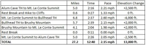
Ended up taking 12 hours 40 minutes to cover 27+ miles, slightly better than the 14 hours we had planned on. We grabbed some burgers in Pigeon Forge before heading back to Newburgh. A long day, but we had a great time.
