Juniper Peak

My 11/14/15 flight from Las Vegas back to Milwaukee was around 5pm, and I needed to return my rental car by 2pm. That left me with an entire morning and part of an afternoon to squeeze in one last hike.

I had read some reviews on SummitPost, and decided to tackle Juniper Peak (6,109′) in Red Rock Canyon.

IMG_1581

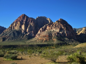
Juniper Peak (on right) from the trailhead

Juniper Peak is situated between Juniper Canyon (to the left in above photo) and Pine Creek Canyon (to the right in above photo). It offers a fun little class 3 climb via Juniper Canyon, along with a number of popular technical climbing routes.

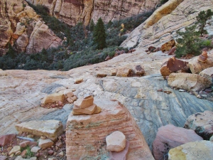
After a short hike to Juniper Canyon, the route ascends a boulder-strewn creek for several hundred yards. From there, I climbed a talus field to reach the base of Brownstone Wall.

IMG_1583

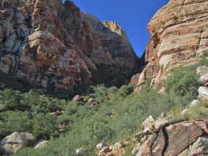
Entering Juniper Canyon

IMG_1587

View back down into Juniper Canyon

The route is marked by cairns the rest of the way up, so the navigation wasn’t too challenging. I passed a few climbers on the Brownstone Wall, but otherwise didn’t see any hikers.

IMG_1590

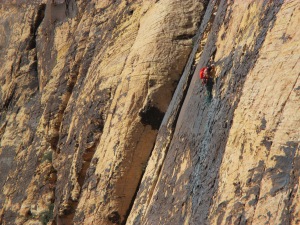
Climber on Brownstone Wall

From here it was another 20-30 minutes to the summit, moving at a quick pace. The route became significantly steeper, but nothing more than class 3.

IMG_1620a

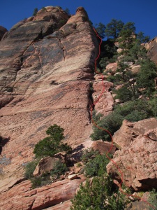
Route highlighted in red

IMG_1616

Looking back down from just below the summit

I reached the top exactly 2 hours after leaving the trailhead. Ended up taking 3:45 round-trip.

IMG_1612

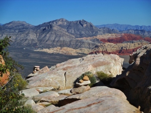
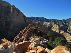
Summit view of Turtlehead Peak (left-of-center) and the Calico Hills (red and yellow rock right-of-center)

IMG_1603

Summit ridge

IMG_1610

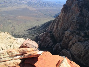
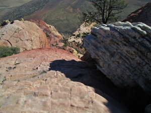
Drop-off into Juniper Canyon

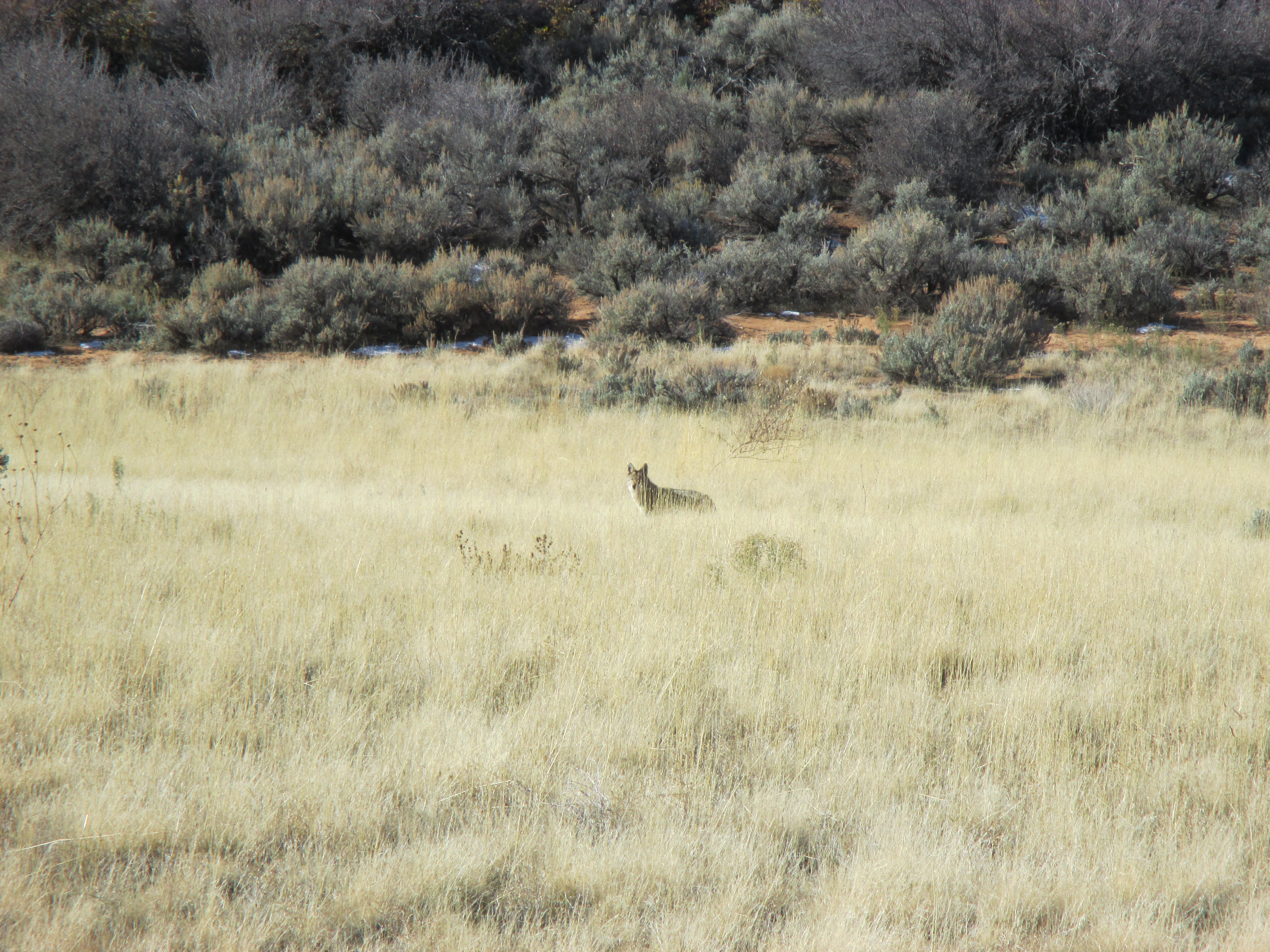
The return trip was straightforward and mostly uneventful. I did bump into a coyote that had been sleeping under some bushes, which I think startled both of us equally.

Published in: on November 19, 2015 at 8:37 pm  Comments (1)  

Peak-Bagging in Zion NP

After interviews in Nevada (Wednesday) and California (Thursday), I had another day-and-a-half left before my flight back home. I had originally planned to spend Friday climbing Mt. Charleston (near Las Vegas), but saw that there had been a decent amount of snowfall over the previous few days. So I wasn’t sure what the conditions would be like.

Then I toyed with the idea of checking out Death Valley, but saw that there had been a massive mudslide in October. Apparently it wiped out some large sections of the park, and I didn’t want to deal with navigating road closures.

Since I was in California on Thursday, I also thought about checking out Sequoia and/or King’s Canyon…but the elevation meant lots of snow up in the mountains there as well.

I started driving back toward Vegas after my Thursday interview, with a vague plan to climb La Madre mountain in Red Rock Canyon. Sometime around 10pm I made a last-minute decision to instead head up to Zion National Park. Allison and I had visited there a few years ago, but there was still a lot of territory we hadn’t had a chance to explore. I caught about 3-4 hours of sleep in a Walmart parking lot on the outskirts of Vegas, then made the 2.5 hour drive to Zion early the next morning.

View along the Kolob Terrace Road

View along the Kolob Terrace Road

One of the two coyotes I bumped into

One of the two coyotes I bumped into

I started hiking from the Wildcat Trailhead, using the Northgate Peaks trail to access the saddle between East Northgate and West Northgate peaks. The climb to the top of East Northgate (7.153′) was pretty simple, even with the snow and ice. The views were top-notch.

Summit view looking south toward South Guardian Angel (left) and North Guardian Angel (right)

Summit view looking south toward South Guardian Angel (left) and North Guardian Angel (right)

View northwest toward Pine Valley Peak

View northwest toward Pine Valley Peak (the edge of West Northgate can be seen far left)

I climbed back down to the saddle, where I chatted for awhile with a couple other hikers.

That's me

That’s me

My next task was West Northgate (7,267′) via the north slopes route. This turned out to be a lot trickier, thanks to the patches of snow and ice covering much of the slickrock surface. I made it about two-thirds of the way to the top before deciding it was too risky to continue. I had no traction, and the smooth surface meant a lack of objects to break one’s fall.

The snow-covered route on West Northgate

The snow-covered route on West Northgate

After throwing in the towel on West Northgate, I spent another couple hours hiking out to Wildcat Canyon before returning to my car.

Wildcat Canyon

Wildcat Canyon

East Northgate, North Guardian Angel, and West Northgate (left to right)

East Northgate, North Guardian Angel, and West Northgate (left to right)

I made it back to my car around 2:30pm, and decided I had enough daylight left for one final peak. I opted for Cave Knoll (6,495′) since I knew it would offer some sweeping sunset views. Since there weren’t any trails in the immediate area, I had to park along the side of the road and bushwhack.

Pine Valley Peak (I think)

Pine Valley Peak (I think)

Last few hundred yards of the ridgeline

Last few hundred yards of the ridgeline

View from the summit

View from the summit

Looking back at the route...lots of fun scrambling and hoodoo-dodging

Looking back at the route…lots of fun scrambling and hoodoo-dodging

It was almost completely dark by the time I made it back. Glad to have had the headlamp, but didn’t really need it. Total distance for the day was something like 12-14 miles.

Sunset view

Sunset view

Published in: on November 15, 2015 at 10:36 pm  Leave a Comment  

Turtlehead Peak

I flew into Las Vegas on 11/10/15 for some residency interviews, and figured I’d take the chance for some hiking while I was there.

I picked up my rental car around noon, and had a few hours to kill before the pre-interview dinner that night. Decided to tackle Turtlehead Peak (6,324′) out in Red Rock Canyon.

Looking up at Turtlehead's summit from the lower slopes

Looking up at Turtlehead’s summit from the lower slopes

Round trip distance was roughly 5 miles, although I accidentally got off-trail for a short while on my way up. It turns out trails through the desert can be tough to follow.

Overlooking the Calico Hills (bottom center)

Overlooking the Calico Hills (bottom center)

Summit view looking south across Red Rock Canyon

Summit view looking south across Red Rock Canyon

Summit view looking east toward Las Vegas

Summit view looking east toward Las Vegas

I made it to the top in 1 hour, with a total round-trip time of 2:02. I was really impressed with Red Rock, and would end up coming back again a few days later…

Published in: on November 15, 2015 at 3:31 pm  Leave a Comment