Last weekend I met up with Dan Knabel – a friend from med school – for a 12 hour rogaine in Cuyahoga Valley National Park. Special thanks to our wives for watching the kids all day.
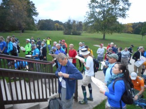
pre-race briefing
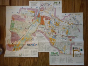
This was my 3rd rogaine of the year (Dan’s first ever). The map came in three pieces and was blown up to 1:12,500, with a lot more terrain detail than I’m accustomed to. Controls #1-19 were worth 10 points, #20-29 worth 20 points, etc. with a maximum control value of 60 points. (There was also a bonus control worth 60 points to be found via a map attached to an unknown control. Sadly we never found this). Maps were distributed a little after 0700, and the race began at 0800.
Dan and I decided to begin by heading eastward toward the large plateau feature surrounded by cliffs. We would then circle back around toward the corn maze in the map’s southwest corner, make our way north to the other river crossing, then re-evaluate where we were based on time.
Our final route in blue (click to enlarge)
From the starting area, we quickly hit controls #47 and #16 to the east. We then headed toward #17, which we somehow managed to miss completely. We gave up on it after 5 minutes of searching (since it was worth a mere 10 points)…but this ended up being the only control of the day that we failed to find. As we were leaving, we ran into another guy who couldn’t find #17, so at least it wasn’t just us.
Dan bagging #38
We then headed east to #28 and #38, which we found with no issues. We had decided to abandon the southeast corner of the map, since the density of controls was a little more sparse than in other areas. We did however grab #67, #58, and #18 (120 points!) as we moved back to the west. This section was a little brushy in places, but briars were few and far between, and we made very good time.
We mostly followed the road for the next few hours, taking a few short side-trips into the forest along the way to hit #24, #8, #4, #35, #23, #49, #2, #51, #3, and #50 on our way to the corn maze at #60.
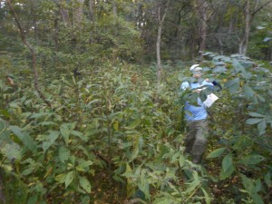
Dan navigating the underbrush near #49
Our biggest hiccup of the day came as we were approaching #51. We apparently overestimated the distance we needed to travel before turning downhill, and overshot the target. This normally wouldn’t be a huge problem, but this had taken us off the edge of the map…and we didn’t realize until far too late that were were hunting for #51 on the wrong hillside. By the time we realized the mistake and backtracked, we had wasted at least 35 minutes.
Things went smoothly after that, though. We walked past a few goats after leaving #3, and found #50 underneath a solar panel.
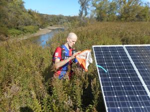
Control #50
The next control, #60, was hidden in a large 3-acre corn maze at the Szalay farmer’s market. We were in & out in about 6-7 minutes.
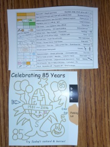
Terrain key (above) and corn maze map (below)
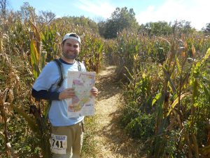
Entering the corn maze

Control #60
We took advantage of the farmer’s market to stock up on apple cider and chocolate covered caramels, which was a solid investment. We then followed the road north toward the western-most section of the map. This was another area with lower control density, so rather than going for all the controls, we only went for the low hanging fruit near the road – #52, #31, #32, #53, and #1. None of these posed much challenge. We then made a quick loop to grab #62, #42, and #33 before crossing back over the Cuyahoga River.
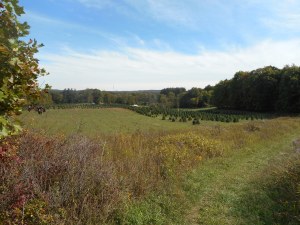
View to the east of #62
After briefly over-shooting #54, we made a quick and efficient northward loop of #34, #63, #55, #64, and #44. At this point we stopped for a few minutes to consider our options. There were 3 hours 30 minutes left in the race, and we were torn between continuing toward the northeastern corner of the map, or retreating back toward the start/finish area and picking off the numerous low-value controls down near the lakes. We decided to go for the higher-value controls to the northeast, which I think was the right choice. It only took 20 minutes or so to grab #43, #12, and #26, then we made quick time walking along the road. A mix of on-trail and off-trail hiking connected #45, #65, #56, #39, and #29. Given our time constraints, we bypassed the low-value #19 and instead made a detour to pick up #57.
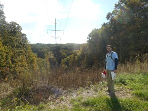
Power line between #55 and #64
Unfortunately, there hadn’t been any water remaining at the last two water stops (at controls #39 and #33)…so we were both pretty dehydrated and rationing the small amount of water we had left.
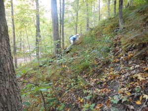
Dan scrambling up a hill
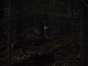
It was starting to get dark at this point, so we slapped on the headlamps and made our way back down the road toward the boy scout camp. In hindsight, a more direct off-trail route would have taken us to #46>#27>15>14>13. Instead we took a longer, more round-about route via the road, netting 40 fewer points and hitting controls #14, #15, #27, and #13. There were 36 minutes left in the race at this point, so we hobbled as quickly as possible back to the finish area.
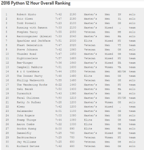
We finished with 12 minutes to spare. Final score was 1490 out of 2190 total possible points. Final rank was 15th out of 31. Approximate total distance of 29 miles (estimated from the phone GPS buried in Dan’s pack, which died after ~10.5 hours).
Overall it was a terrific event. Would highly recommend. And if anyone reading this knows where the bonus control was hidden, leave a comment! I’m still curious.


