Kettle Moraine 100k

Yesterday (June 6, 2015) I was fortunate enough to set a new distance PR at the Kettle Moraine 100k.

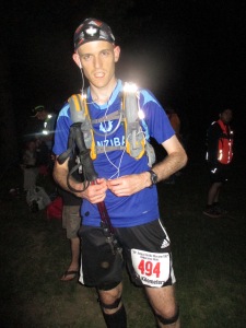
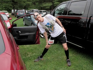
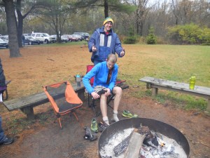
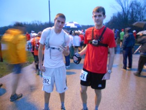
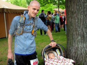
Hanging out with Micah before the race

Hanging out with Micah before the race

Something like 400 runners from the 100-mile and 100-kilometer events set off from the Nordic Loop trailhead at 6:00am. Those of us running the 100k would do a single 63 mile out-and-back course, while the 100-milers would follow the same route…then complete another 38 mile out-and-back course (the “fun run” course I ran last year).

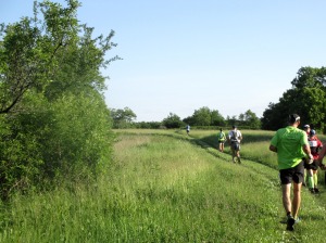
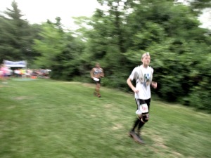
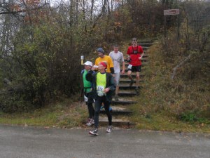
mile 6

mile 6

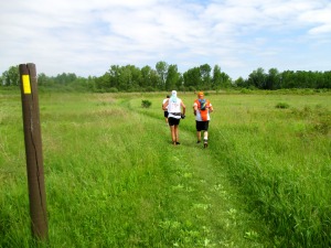
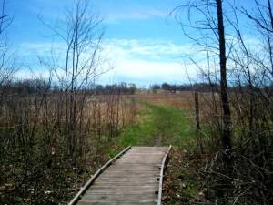
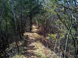
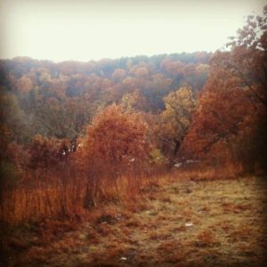
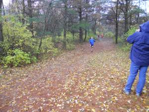
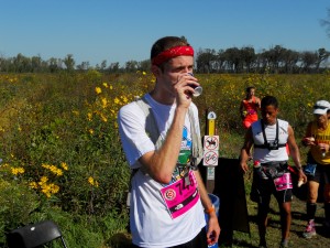
The first 7.5 miles followed the Nordic cross country ski trails – mostly smooth and grassy footing wide enough for 3-4 people to run side by side. So despite the massive number of runners, traffic didn’t get too congested. This was followed by 19 miles on the Ice Age Trail (about 10 miles of dirt singletrack with lots of rocks, roots, and rolling hills, and 9 miles of open exposed grassland, pictured below). We then left the IAT for another 5 miles on the Scuppernong trails (hilly and wooded, with lots of pine trees) before reaching the turnaround point at mile 31.5.

mile 16

mile 16

I knew the tendinitis in my knees was likely to flare up at some point in the day. By keeping my pace slow (jogging flat stretches and hiking the hills), I was able to postpone the knee problems until around mile 35-40.

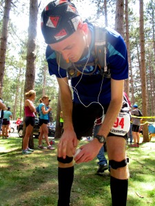
mile 31.5 (halfway point)

mile 31.5 (halfway point)

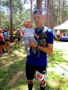
I was also able to see Allison and Micah once every 5-9 miles throughout the day, including the Scuppernong turnaround point.

Matt & Micah

Matt & Micah

The last 20 miles or so was pretty tough, but I eventually found a second wind and was able to pick up the pace for the final few miles.

mile 63

mile 63

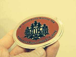
And I got another belt buckle, which will be useful.

100k belt buckle

100k belt buckle

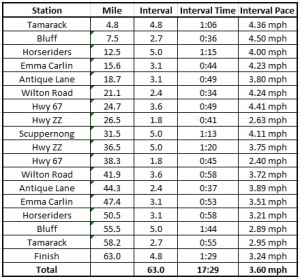
You can see my splits in the table below. Time spent at aid stations is included, so my actual “moving pace” was somewhat faster.

Pace Sheet

Ended up finishing 78th out of 109.

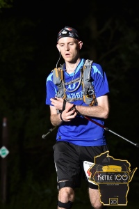
crossing the finish at mile 63

official finish line photo

Published in: on June 7, 2015 at 4:22 pm  Comments (2)  

Geneva Lake Training Run

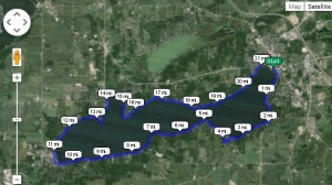
I had a free afternoon this week, so on a whim I decided to go run a loop around Geneva Lake. I’d never actually been to Geneva Lake, but I had a vague idea that it was surrounded by lots of mansions. And I knew that there was a public footpath following the lakeshore.

Geneva Lake

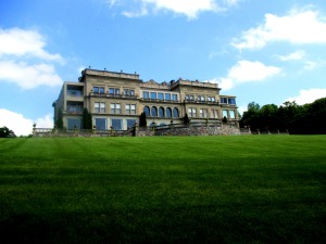
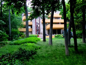
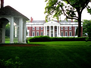
There were definitely lots of mansions. It turns out Geneva Lake was a popular destination for wealthy Chicago-area families during the last century…but the earliest settlers made an agreement that the ~20 feet of land along the shoreline would remain open to the public.

So at least 90% of the route involved cutting through the backyards of said mansions – including the estates of the Wrigley (chewing gum) and Schwinn (bicycle) families.

???????????????????????????????

???????????????????????????????

???????????????????????????????

Since the footpath is maintained by individual landowners, the trail surface changed every time I crossed a property line. So over the course of a typical half mile, I’d be running on cobblestone, grass, brick, dirt, gravel, wooden planks, and concrete.

???????????????????????????????

I wasn’t going at a breakneck pace (22.5 miles in 4.5 hours = 5mph)…but even so, the run was remarkably pain-free. Not even a little sore the next morning. So I’m cautiously optimistic about the 100-miler I’ll be attempting this October.

Published in: on June 27, 2014 at 10:20 pm  Comments (2)  

Kettle Moraine 38 Mile “Fun Run”

My racing schedule is relatively light this summer, but I wanted to find a longer training run in preparation for the Heartland 100-miler, which I’m signed up to run in October.

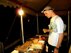
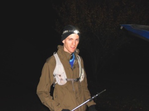
Since I’m a wimp when it comes to running in hot weather, and since I’ve been wanting to gain more experience with night running, the Kettle Moraine 38-mile overnight “fun run” was a good choice.

Pre-race

Pre-race

Allison was the real MVP of the day. She drove around all night meeting me at the various aid stations, probably only managed 2-3 hours of sleep, and was STILL able to masterfully avoid hitting a deer on the drive home at 4:30 am.

Mile 0.02

Mile 0.02

The weather was almost perfect, too. The temperature was around 70°F when I started, and dropped down to the mid-50’s throughout the night. We got drenched by a thunderstorm shortly after starting. It lasted maybe 20 minutes, then turned to a light drizzle for another few hours.

Mile 10

Mile 10

The views were terrific until mile 5 or 6. By then it was completely dark, and I switched on my headlamp for the remainder of the race.

Mile 14

Mile 14

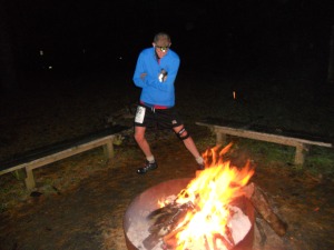
Running all night on a trail is tough to describe, except to say that it’s awesome. For the tired and hungry guy stumbling through the woods, there are few finer things in life than the sight of bonfires and Christmas lights and the smell of freshly cooked food.

Mile 17

Mile 17

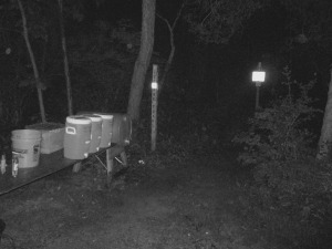
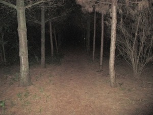
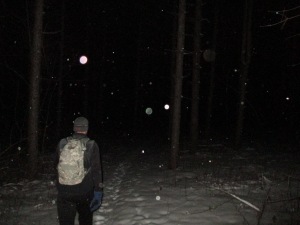
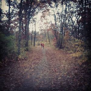
There were a couple of lonely stretches of forest that struck me as a little creepy (see picture above). At one point, I could have sworn I heard someone picking a banjo out in the woods.

Mile 20

Mile 20

Things were mostly uneventful, though. I saw a few cats, a raccoon, several bats, and a white moth the size of my hand. My knees gave me almost no trouble at all, and I was still running strong when I reached the finish line. This was probably the most pain-free ultra I’ve ever run.

Finish line

Finish line

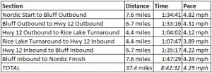
My final time was 8:42:32…good enough for 18th place out of 67 starters (57 finishers).

Post-race

Post-race

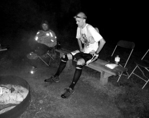
Starting time: 7:40 pm

Finishing time: 4:22 am

Below are the splits, which include stops for food, bathroom breaks, etc.

kettle 38

Published in: on June 8, 2014 at 8:57 pm  Comments (1)  

Kettle Moraine South: IAT Traverse

This past Sunday (5-4-14), I ran the ~31 mile length of Kettle Moraine South via the Ice Age Trail. It was a very spur-of-the-moment thing (I got the idea for the run on Saturday night), but something I’ve had in the back of my mind for a year or two.

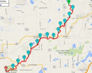
The Route

The route

Since I’m still dealing with a few minor aches and pains from last month’s 50-miler, I decided to take things very easy. Probably 60% running and 40% fast walking, with about 30 minutes worth of rest stops. There were definitely no plans to set any PR’s.

1/2 mile north of Brady's Rocks

1/2 mile north of Brady’s Rocks

The weather was perfect: mid-50’s and sunny for most of the day. I ran in silence for the first hour or so, then spent the rest of the day listening to the Fleet Foxes. Excellent music for a slower-paced run.

1/2 mile south of the Horseriders Campground

1/2 mile south of the Horseriders Campground

The run was entirely self-supported, but the cool weather made that pretty manageable. I carried 1.5 liters of water, and refilled once at the Horseriders Campground – near the midway point. I also brought along 6 or 8 Hammer gels, but only ended up eating 2 Milky Way bars and a bag of chips. Since I’m a health nut, and all.

Sunset, 2 miles from the finish

Sunset, 2 miles from the finish

This was a one-way endeavor, so my lovely wife was kind enough to pick me up at the southernmost tip of the Kettle Moraine state forest.

Total time = 7 hours, 20 minutes

Published in: on May 6, 2014 at 6:31 pm  Comments (4)  

Kettle Moraine North: Overnight Winter Hike

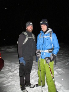
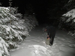
Last weekend, a friend and I hiked the 15.2 mile section of Ice Age Trail from the Hwy P trailhead to Butler Lake. We toyed with the idea of completing the full length of Kettle Moraine North (~32 miles)…but the fresh snow made for slower going than we’d anticipated. Some of the deeper drifts were well up over our knees.

Time: 8:50 pm – 2:45 am

Overnight low: 1°F

Setting off

Setting off

Mile 3

Mile 3

IMG_0024

Mile 10

Published in: on January 25, 2014 at 4:48 pm  Comments (3)  

50 Mile Run: Milwaukee to Lake Mills

Two weeks ago, I dropped out of a 50 mile race around mile 35 because of iliotibial tendonitis in my left knee. It was a little disappointing, and I expected the knee pain to hang around for at least a few weeks.

I ended up recovering a lot faster than expected, however, and decided to attempt one final long run before winter set in.

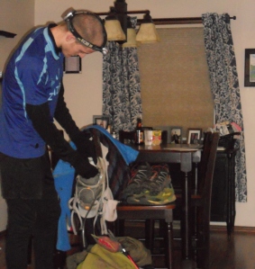
Packing my gear

Packing my gear

After only 3 hours of sleep on Friday night, I woke up to eat some Ramen noodles and finish packing. Allison drove me a couple miles down the road to Greenfield Park, where I started my run on the New Berlin Trail at 3:30 am.

3:30am

3:30 am

I followed the New Berlin Trail for the first 7+ miles as it cut through the suburbs of Milwuakee before dumping me out into downtown Waukesha. My legs felt great, and I made decent time. I started off using my headlamp, but flipped it off after a few miles since there was plenty of moonlight to see by. I’m a huge fan of night running because of the cool damp air (mid-30’s today) and complete silence and solitude. I was a little startled to see a guy sleeping on a bench next to his mountain bike at mile 3…but aside from that, this section was uneventful.

My route

My route (click to enlarge)

I reached Waukesha at 4:57 am. It was a little eerie running through the deserted streets (but in a “wow, this is really cool” kind of way).

Running through Waukesha at 5:00 am

Running through Waukesha at 5:00 am

It was around this time that I glanced over my shoulder, and in the process managed to land awkwardly on my left leg. I felt a sharp pain around the patellofemoral region of my knee (the same knee that had given me trouble 2 weeks ago, but a different area of the knee). I didn’t think it was very serious, but it flared up whenever I tried to jog. Walking was mostly painless.

I wasn’t doing this for speed, though, so I decided to press on. I spent most of the rest of the day grinding out a stiff-legged 15 min/mile pace, with only the occasional spurt of running.

I took my time navigating the streets of Waukesha, and joined up with the Glacial Drumlin State Trail a few miles later at 5:43 am.

Glacial Drumlin State Trail a few miles west of Waukesha (shortly after sunrise)

Glacial Drumlin Trail a few miles west of Waukesha (shortly after sunrise)

The next ~7 miles to Wales, WI was also uneventful. I encountered a couple guys training with street skis, but the trail was nearly deserted. I sent Allison a text, and arranged to meet her in Wales.

Changing my shoes in Wales

Changing my shoes in Wales

I reached Wales at 7:34 am, changed my shoes, threw on a jacket, grabbed a Snickers, and started off again at 7:41 am.

Leaving Wales

Leaving Wales

I took a few short breaks during the ~5.5 mile stretch between Wales and Dousman. Allison had driven ahead to scout things out, and surprised me by jogging back to meet up with me. We arrived in downtown Dousman at 9:18 am and decided to stop for a meal. I had an outstanding NY Strip with eggs and hash browns for only $8 at “Deb’s Main Street Diner”. After the meal, I walked back to the car to grab my ipod and warm up for a few minutes…so it was already 10:22 am when I started off again.

About 3 miles west of Dousman

About 3 miles west of Dousman

After leaving Dousman, the asphalt trail transitioned to crushed limestone for the remainder of the day. Much easier on my knees. I reached the next town – Sullivan, WI – at 11:55 am. Along the way, I passed a few other runners. I also saw a group of hunters in neon orange successfully shoot down a goose (or duck, or something) about a quarter of a mile away from the trail.

Resting in Sullivan, WI (mile 30)

Resting in Sullivan, WI (mile 30)

Allison had made a quick trip to Home Depot, so I actually beat her to Sullivan by a few minutes. I took advantage of the extra time by resting on a picnic table. The temperature was around 50 degrees by now, but a storm was beginning to roll in. So I donned a waterproof jacket and set off at 12:14 pm.

I met up with Allison again when the trail crossed Co. Rd. D about 5 miles later (1:37 pm). At this point I was feeling pretty tired from my lack of sleep the night before, so I took an hour long nap in the car.

Checking the map

Checking the map

I know that I started moving again at 2:43 pm, but my memory of the last 15 miles is pretty fuzzy. I remember seeing some wildlife (a cat, a racoon, a deer, a hornet’s nest, a dead mouse) and I remember my brain doing funny things. My hamstrings were murderously tight and sore at this point, and I remember being oddly happy when my feet started getting blisters (because I thought it would distract me from the sore hamstrings, or something). I definitely experienced all the extreme-highs and extreme-lows, physically and psychologically speaking.

I reached the Jefferson bypass at 4:10 pm and the Jefferson trailhead at 4:56 pm. It started getting dark again at this point, so I threw on a headlamp and made the final trek to Lake Mills in a raging windstorm and steady rain. I met up with Allison in Lake Mills at 6:32 pm, and we called it a day.

Arriving at Lake Mills

Arriving in Lake Mills

The trip ended up being approximately 50 miles. I didn’t make it all the way to Madison (70 miles)…but that might end up being one of my goals for next year.

Published in: on November 17, 2013 at 6:00 pm  Comments (1)  

tBunk Endurance Challenge “Fifty” Miler

Why the scare-quotes? Because, for me, the race only lasted 35-36 miles.

10 minutes before the 7am start

10 minutes before the 7am start

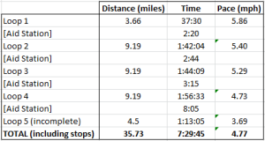
I actually got off to a great start. The headlamp was only necessary for about 15 minutes, and I spent the first 3.66 mile loop chatting with a guy from Chicago. At the aid station I said a quick hello to Allison, shed my inner thermal shirt, and started off on my first of “five” 9.19 mile loops.

Allison, Don, and Andrea were my support crew for the day. Thanks guys!

Allison (not pictured), Don, and Andrea were my support crew for the day. Thanks guys!

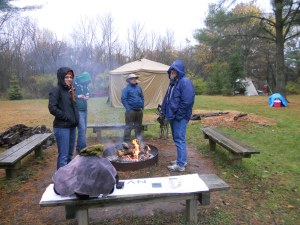
The weather was absolutely perfect for long-distance running: mid-40’s with lots of fog and intermittent rain showers. We even got some hail at one point. So it probably wasn’t perfect weather for all the non-runners huddled around the campfire.

One of many scenic overlooks along the trail

One of many scenic overlooks along the trail

The first 9.19 mile loop also went well. I ate my hammer gels about 30 minutes apart, which seemed to work pretty well. I was feeling relatively fresh when I came into the aid station, said a quick “hello” to everyone, and took off with some fresh bananas and a full bottle of Heed.

Mile 22

Mile 22

I really don’t remember much about the second loop, except that it seemed to go quickly. I was starting to get some nagging pain in my left knee, but didn’t really think much of it. My energy level was fine, and I was on pace to shatter my goal of an 11 hour finish.

Mile 26

Mile 26

Somewhere between miles 25 and 30, the knee pain started to become significant. I tried listening to music to distract myself, without much luck. I kept thinking of the Frozen Otter race from two winters ago, when I gritted out 20+ miles of knee pain and ended up with a limp for the next three months.

By the time I finished the third 9.19 mile loop, my pace had slowed to a 4 mph speed-stagger.

DSCN4692

Mile 31

The frustrating part was that I still felt fantastic overall. Were it not for that 2 square inch area of iliotibial tendonitis, I think I could have made it through 100 miles, much less 50. I tried fixing things up with new shoes and some duct tape, but only made it about 4 miles into the next loop. I lost my footing on a slippery hillside, felt a lightening bolt of pain in my knee, and decided to call it quits. So I ended up with my first ever “DNF” in a race (did not finish; did nothing foolish).

Sooo…I’ll give my knee a few weeks to heal, then start training for another 50 mile attempt next spring. My splits:

tbunk splits

Published in: on November 3, 2013 at 4:36 pm  Comments (5)  

Door County

Matt and I couldn’t let a fall season pass us by without going on at least one camping trip.  So last weekend we drove to Peninsula State Park in Door County to enjoy the fall colors and visit an area of Wisconsin we had not yet been to.  We camped in the park – at the South Nicolet Bay campground.  Due to the chilly weather, it was not overly crowded, and the scenery was gorgeous.  The leaves had far more vivid colors than in Milwaukee, and our campground was right on the water – allowing for beautiful Lake Michigan views.  Our campsite was also ideally located for walking all around the park – which we took full advantage of on Saturday, as we explored the west side of the park in the morning, and the east side in the afternoon.

After getting Matt moving on Saturday morning (we arrived late Friday night, set up camp, and tumbled into bed) we decided to walk on the Sunset Bike/Hiking Trail that runs right along the lake to the historic Eagle Bluff Lighthouse.  It used to be, and still is, a working lighthouse.  However it is no longer manned due to a solar panel and battery powered light.  However, the lighthouse has been restored to what it looked like when it was a manned lighthouse, and was very interesting to walk through.  Matt and I walked back to camp through the middle of the park to get some different views and just enjoy the beautiful colors!  We headed into the small town of Fish Creek for lunch and ended up at The Blue Horse, which Matt highly recommends to any coffee drinkers.  They also had delicious sandwiches.

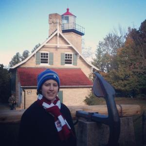
Me outside of Eagle Bluff Lighthouse

Me outside of Eagle Bluff Lighthouse

In the afternoon, we hiked from the campground to Eagle Tower for fantastic views of the other side of the park.  We hiked back to camp along the Eagle Trail, which we would highly recommend.  It was a gorgeous hike between the lake and the bluffs on this side of the park.  There were many small caves and outcroppings, as well as just gorgeous views that were well worth the hike.

Matt standing on Eagle Tower

Matt standing on Eagle Tower

Me overlooking Door County from Eagle Tower

Me overlooking Door County from Eagle Tower

The walk along Eagle Trail.  We found a cave!

The walk along Eagle Trail. We found a cave!

After getting caught in a late afternoon shower as we were hiking, we made it back to camp and decided to drive to the small town of Sister Bay to check out their Fall Festival we had been hearing about.  Unfortunately, all of the small vendors started packing up shortly after we arrived, so after browsing a little, we headed back to camp to start dinner. Much to our surprise, we got stuck in a small hail storm that left the ground quite white for a short time.  Fortunately, that turned out to be the end of the poor weather, so we were able to enjoy the campfire for the evening.  However, due to all the rain, firewood that we had bought was a little damp (we kept it in our car, but it must have already been a little damp when we bought it) and it took quite a while to get the fire started.  I lost patience, but fortunately Matt came through and we were able to make out Hobo stew over the fire as planned.  We may have enjoyed a few marshmallows in the mix too 😉

On Sunday morning, after enjoying our campfire one last time, we drove to White Fish Dunes State Park and took a hike along the length of the park to enjoy the dunes and the different scenery it had to offer.

The view over White Fish Dunes State Park from the top of one of the dunes

The view over White Fish Dunes State Park from the top of one of the dunes

Then it was time to head home, and back to the reality of jobs.  But we would love to go back to Door County and enjoy it’s peacefulness again!

Published in: on October 23, 2013 at 10:08 pm  Comments (6)  

How Not to Dominate a Rogaine Competition

Matt here. I just finished up my first organized rogaine event this afternoon, hosted by the Wisconsin Adventure Racing Society in the Southern Kettle Moraine unit.

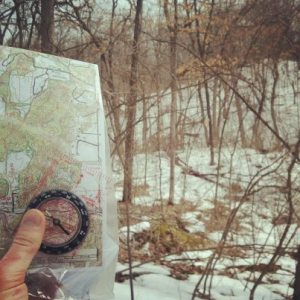
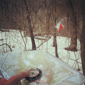
The event itself was loads of fun – bushwacking through the forest with map and compass to track down various “controls” (little flag contraptions, where competitors punch their cards to score points) as quickly as possible. I’m hoping to convince Allison to join me at the 2014 World Rogaining Championship in South Dakota next summer, so it was great getting to put my navigational skills to the test.

rogaine 2

As far as navigation goes, I was pretty efficient at finding the controls. Pretty happy with myself in that regard. Unfortunately, I’ve had some bizarre, nagging pain in my left quadriceps tendon the last couple weeks that basically prevented me from jogging more than a few strides at a time. (I’ll be honest…I’m pretty concerned about being able to compete in the Zumbro 50-mile ultramarathon in two weeks.)

But since most of the course was covered in ice, snow, thornbushes, and thick undergrowth, I probably wouldn’t have been able to sustain more than a fast walk even under the best conditions.

rogaine 1

My real problem came later, as I approached the 12th control (out of 18 in Stage 1 of the event; or 23 total). When I reached down to retrieve my punch card, it just wasn’t there. Somehow the thing had slipped out of my bag. I spent 30-40 minutes retracing my steps with no luck, then decided to just head back to the shelter and call it a day. It was probably smart quitting early anyway, considering the bum knee.

The take-home lesson, then:

DON’T DROP YOUR PUNCH CARD.

So anyway, the outcome could have been better…but I had a great time regardless. I definitely plan to sign up for some future orienteering events and adventure races, once I get this knee healthy.

Published in: on March 30, 2013 at 5:56 pm  Comments (5)  

Ice Climbing with the Wilderness Medical Society

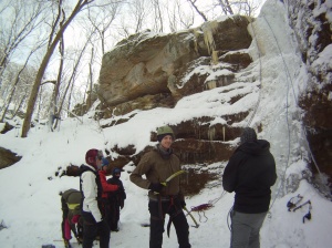
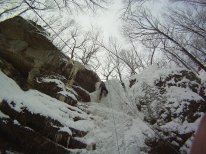
I currently serve as one of the co-presidents of MCW’s Wilderness Medical Society, so this weekend I took advantage of my position of power to organize an ice climbing trip. This is one of those activities that’s been on my bucket list for awhile, and the folks over at Apex Adventure Alliance gave us a sweet group discount for some guided climbing.

Wielding my ice axe

Wielding an ice axe

My second ascent

My second ascent

It took a little getting used to, but I decided that ice climbing is quite a bit easier than standard rock climbing. It’s kind of nice being able to create your own handholds and footholds.

Approaching the clifftop

Approaching the clifftop

Allison was unfortunately unable to come, but I think I’m now proficient enough to get us both to the top of Everest (cough).

Anyway, one of my friends was kind enough to film me climbing one of the smaller ice columns:

Published in: on February 3, 2013 at 5:28 pm  Comments (1)  

Race Report: Glacial Trail 50K

Allison, my brother and I left Milwaukee at 5:00am yesterday to drive up to the northern unit of Kettle Moraine State Forest. Trent and myself were competing in our first 50-kilometer trail race – the Glacial Trail 50.

After checking in at the Greenbush Town Hall, we headed outside for the 7:00am start.

Approaching the starting line

The weather added an extra element to the race, with temperatures in the 40’s-50’s and a steady rain that lingered well into the afternoon.

You can also see that I had a GoPro camera strapped to my chest. I had the device programmed to take a picture every 2 seconds, with the intention of creating a timelapse video of the race. Unfortunately, the rain and dim lighting made for some really blurry, poor-quality pictures. So maybe I’ll try again next time.

Approaching Aid Station #1 (mile 7)

After about a half-mile section of road-running, the course joined up with the Ice Age trail (via a short connector trail). The entire course was relentlessly hilly, but this section offered some particularly rocky, treacherous footing. We nonetheless made good time, and took the opportunity to grab some Hammer Gels at the first aid station (mile 7).

The next leg of the course was a 6.3-mile stretch to Butler Lake (the starting point for last winter’s Frozen Otter race). None of the hills we faced were particularly large, but the trail was a constant up-down-up-down-up-down. The trail finally left the woods around mile 12. We ran across a prairie for a short while, then re-entered the forest immediately before arriving at the Butler Lake aid station.

Approaching Aid Station #2 (mile 13.3)

I stopped here to inhale a few orange slices, then Trent and I continued on toward the 50K turnaround-point (another 2.2 miles down the Ice Age trail). A little over 50 minutes later, we came jogging back into Butler Lake.

Departing Aid Station #3 (mile 17.7)

We were both feeling pretty beat-up at this point, so we each took an Ibuprofen.

Crossing the prairie just past Butler Lake (mile 18)

It was during the 6.3 mile section between aid stations #3 and #4 that I really started to hit a wall. I’d been intentionally going easy on the energy gels, hoping to avoid a repeat of the vomiting problems from last month’s marathon…and I think the lack of calories was starting to catch up with me.

So I inhaled a couple more Hammer Gels around mile 20, and within ten minutes I was once again feeling relatively fresh.

Approaching Aid Station #4 (mile 24)

We each ate some fruit and candy at the aid station, then grabbed more Hammer Gels for the road. Allison was nice enough to stuff everything into my handheld water bottle carrier, since my fingers were too swollen to manipulate the zipper.

The final 7-mile stretch was kind of a blur (at least for me). We were both pretty exhausted. Around mile 28, my foot caught a root as we were sprinting down one of the steeper hill sections. I went completely airborne, and my bad knee (already sore at this point) came smashing down on a rock as I face-planted into the ground. I spent a minute or two walking off the pain, and Trent was nice enough to wait until I could resume jogging.

The rain was coming down really heavy at this point, so the final stretch through the deserted streets of Greenbush was kind of surreal.

We ended up finishing with a time of 6 hours, 1 minute, and 17 seconds. Trent probably could have broken the 6-hour mark, had he not stayed back with me and my bad knee.

Standing at the finish line (mile 31)

I’m definitely sore today, but we had a great time. Also, I should thank Allison for taking all of the pictures!

Section Splits

UPDATE: I went ahead and made the timelapse video anyway.

Published in: on October 15, 2012 at 12:59 pm  Comments (3)  
Tags: , , , , ,

Race Report: North Face Endurance Challenge Marathon

I ran my first trail marathon last weekend, and it was pretty brutal. The race took place in the southern unit of Kettle Moraine State Forest – on some of the same trails we hiked on with my sisters last summer.

The marathon started at 9:00am, which meant that we’d be running into the early afternoon (highs in the mid to upper 70’s). The course was equipped with four aid stations, dividing the run into five “segments” of 6.3, 5.3, 5.6, 5.3, and 3.7 miles. The total elevation change was reported as 3,218 feet.

Course Map

Start to Ice Age Aid Station (6.3 miles): This segment mostly followed horse trails, providing us with plenty of passing room. This meant there was virtually no bottle-necking (a major problem at our last race) – but it also meant running through some sections of loose sand. And a few horse droppings. I sipped a few ounces of diluted Powerade from my Nathan vest every couple miles, and ate a GU gel around mile 3. I was feeling great when I hit the first aid station, so I blew straight through it. Average pace for segment #1 = 9:41 min/mile

Ice Age Aid Station to Wilton Aid Station (5.3 miles): Immediately after leaving the first aid station, the course turned onto the Ice Age trail. This meant firmer footing, but also a narrower and more rugged trail. I still felt terrific, so it was a real challenge not to get over-zealous with my pacing on this section. After a couple miles, the trail spilled out of the trees and into a sprawling prairie area, where we’d be running the next 12 miles or so in the baking sun (and yes, 76°F does feel like “baking” when you’re running long distances). I’d only eaten a few GU chomps on this stretch, so I decided to stop to choke down some steamed potatoes and Nuun when I arrived at the second aid station. Average pace for segment #2 = 9:37 min/mile

Wilton Aid Station

Wilton Aid Station to Hwy 67 Aid Station (5.6 miles): This was easily the hilliest section of the course, featuring about a two-mile stretch of constant up-down-up-down. I was still feeling relatively fresh, but decided to hold back on the hills and save my energy for the flat sections that I knew were still coming. The potatoes I’d eaten were definitely not sitting well, but I decided to eat another GU gel anyway. Average pace for segment #3 = 10:42 min/mile

Kettle Moraine

Hwy 67 Aid Station to Piper Aid Station (5.3 miles): This was where everything started to go rapidly downhill. Right as I stopped for a cup of water, there was a stabbing pain in my stomach. I spent the next five minutes puking my guts out, mentally berating myself for eating all those potatoes. I only had another nine miles ahead of me, but everything from this point on looked less like a *run* and more like a *drunken stagger*. So I don’t remember much from this section, except that I was really dizzy and really thirsty. My stomach, unfortunately, couldn’t handle more than the occasional sip of water. Average pace for segment #4 = 14:32 min/mile

Piper Aid Station to Finish (3.7 miles): I was feeling really dehydrated by this point, but the ol’ stomach just wasn’t accepting much of anything. I tried stopping for several minutes, but couldn’t get rid of the nausea. With one mile remaining, I once again stumbled into the woods and threw up. Then I threw up again…and again…and again. Then I gritted my teeth and forced myself to run the final mile to the finish line. Success! Average pace for segment #5 = 17:18 min/mile

So the race obviously didn’t go as smoothly as I’d hoped. Ah well. I still have that 50k to look forward to next month.

Published in: on September 23, 2012 at 4:48 pm  Comments (1)  
Tags: , , , ,

Race Report: DWD Devil’s Lake Half Marathon

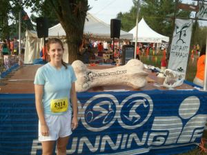
On Saturday, Allison and I awoke at 3:30am for the two hour drive to Devil’s Lake State Park. We had signed up to run the Dances with Dirt half marathon together – with Allison setting the pace and me tagging along as the photographer/time-keeper/live entertainment.

Allison by the trophy platform

The race began at 7:00am, and quickly funneled the 600-or-so runners onto single-track. This was the only significant downside to the race. Thanks to bottlenecking, we were forced to walk many of the uphill sections during the first several miles.

Trying to keep up with the blistering pace

Section 1: The initial 4.2 miles of the course featured 1290 feet of elevation change – most of it uphill. We followed the Ice Age Trail through large sections of forest…

Speeding through one of the flat sections

…before emerging onto some grassland for a couple more miles of rolling hills.

Some scenic terrain

Hi there

By the time we reached the first aid station, the crowd was finally beginning to thin out. We grabbed some water and GU gels, then proceeded to the next section of trail.

Section 2: This 4.7 mile loop took us along some of the scenic bluffs overlooking the park. It offered another 1360 feet of elevation change, including a few sections like this:

One of the trickier descents

So needless to say, we finished the race feeling like we’d just run 13.1 miles on a StairMaster.

Aid station #2

Section 3: The final 4.2 miles had us retracing our steps back to the start/finish line. So another 1290 feet of elevation change – this time mostly downhill.

Charging downhill, alongside another (practically naked) runner

Attacked by an Ent!

To give an idea of how challenging the course was, we trotted across the finish line with official times of 2:38:49 and 2:38:50. And yes, Allison beat me. I wasn’t going to be the jerky husband who darts in front at the very end.

For comparison, Allison normally finishes her training runs of 13.1 miles in about 2:10:00, going at a sub-maximal pace. My 13.1 mile training runs are typically under 1:50:00.

Approaching the finish line

Published in: on July 15, 2012 at 6:40 pm  Comments (2)  

Race Report: Frozen Otter Ultra Trek

The Frozen Otter is an annual winter race on Wisconsin’s Ice Age Trail. According to the event’s website:

“The Frozen Otter Ultra Trek is by far one of the toughest races in the Midwest and with roughly a 2% completion rate, possibly the country. Racers traverse 64 miles of Wisconsin’s hilly terrain left in the wake of the great Wisconsin Glacier. As if the sheer feat of conquering the mileage isn’t enough, racers must do it completely self supported, on trail, in the dead of winter.

Racers may participate as a solo only this year (although participants are encouraged to race with others) and must carry a variety of gear to ensure their safety during the event. For those who don’t want to commit to the entire distance, a 32 mile half distance option is also offered. Full distance racers have 24 hours to conquer the distance and 12 hours are allowed for the half distance participants.”

For those who know me, I don’t have a lot of experience with this sort of thing – aside from the occasional short backpacking trip. So needless to say, I signed up for the 12 hour, 32 mile race. I figured it would be a great way to test my endurance, and maybe build up to slightly longer races…like this one in Alaska.

Ready to go

Butler Lake trailhead

The half distance race started at 10:00 am, and was broken up into 4 sections of 7.42, 9.06, 9.06, and 7.42 miles (for a total of 32.96). At the end of each section was a checkpoint, where racers could warm up by a fire and fill up on energy drinks, hot cider, hot chocolate, and sausages. Since Allison was kind enough to come up and support me, she ended up volunteering at these checkpoints throughout the day.

During the first section of the race, I felt great. It was sunny, the temperature was up around 18°F, and I made pretty good time by alternately walking and jogging.

About half a mile in
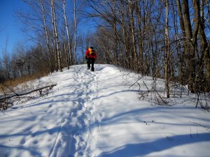
One of countless small hills

After a brief stop for energy drinks at the first checkpoint, I took off at a trot for the next leg of the race. I made it perhaps another four miles before my right knee became painfully tight. I’ve had problems with my iliotibial band for years, so I decided to just take a couple Ibuprofen and keep moving. I also tried listening to some physiology lectures on my iPod…but that lasted about seven minutes before I flipped back to my music.

Yes, part of the trail was in black and white

Yellow Ice Age Trail marker

A lonely section of trail

The sun was starting to get low by the time I reached the second checkpoint, and my knee was definitely hurting a lot. I rested for probably twenty minutes or so, taking the opportunity to inhale some hot sausages and talk with Allison (who jokingly pointed out the icicles forming on my face and hair, and the frozen blood-cicle where I’d gotten a bloody nose).

Climbing more hills

The third section was pretty brutal. I was hobbling on my bad knee, making poor time, and I’d pretty much given up on finishing the race within the 12 hour limit. It also became dark after a few miles, so I had to strap on my headlamp and take extra care not to twist my knee on the more treacherous sections of trail.

Sunset

Two Ibuprofens and a Hammer Gel later, and I was warming up by the fire at the third checkpoint. I figured I’d made it too far to quit, but I was planning to at least thaw out by the fire and change into some dry socks. Then Allison told me it was only 6:55 pm. That 10:00 pm deadline was actually in striking range…so I scrapped my plans and left as quickly as possible.

The good news was that my bum knee was less noticeable on the final 7.42 mile stretch. Unfortunately, that’s because it was eclipsed by periodic spasms of pain in both hips when lifting my legs. No real “injury” here, I don’t think…my legs are just horribly out of shape. The next time I attempt a race like this, my training program is going to consist of more than just a handful of 2 mile runs and a single 13 mile hike in the snow.

Anyway, I was able to keep my legs moving and finish the race at 9:30 pm. My time of 11 hours, 30 minutes was good enough for an 8th place finish (out of 29) in the 32 mile division.

At the finish line, cider in hand

Clothing

Base layer: Reebok polyester shirt; Terramar polyester pants

Mid layer: Norsewear wool sweater; Nike polyester sweats

Outer layer: Marmot Gore-tex shell

Footwear: SmartWool socks; SealSkinz waterproof socks; North Face Ultra 105 GTX XCR mid trail running shoes; Liberty Mountain nylon gaiters

Other: Thinsulate waterproof gloves; Seirus balaclava; Polarlens G7 multisport sunglasses

All the clothing and gear

Gear

North Face Terra 45 backpack

Full change of clothing

Shelter (tarp; rope; stakes)

Maglite; headlamp; spare batteries

Emergency blanket; hand warmers; foot warmers

Lighter; fire-starter; first-aid kit

Camera; phone; iPod

Sandwiches; water; tons of energy bars
Published in: on January 22, 2012 at 8:06 pm  Comments (20)  

Nicolet National Forest – Hidden Lakes Trail

Between my med school classes and Allison’s weekly commutes to Indianapolis, we were fortunate to find a free weekend to go backpacking this month. This past weekend we made the ~4.5 hour drive up to Nicolet National Forest to check out the Hidden Lakes trail (a little west of Eagle River, WI). The trail turned out to be aptly named, passing within view of 11 different lakes – many of them tucked away miles from the nearest road or building.

That's us

Our planned route was approximately 13 miles long, though our trip ended up being more like 15 thanks to a little…um…detour we took. More on that shortly.

A smaller, unnamed lake

We started out from the Franklin Lake trailhead around noon, and made pretty good time travelling southwest toward Pat Shay Lake. Since we only planned to camp for one night, our packs were considerably lighter than on previous trips out west and on the AT.

Pat Shay lake

Around 7 miles into the trip, the man carrying the map inadvertently made a wrong turn. We walked a good fifteen minutes or so before realizing we’d left the main trail, then couldn’t agree on whether to double back or keep exploring (I’ll leave you to figure out which option Allison was in favor of).

"I could swear it was back here somewhere"

To make a long story short, we eventually found the main trail and continued another several miles before stopping along Butternut Lake to set up camp. Someone else had left behind a fire ring, which we took full advantage of.

Our campsite

Allison making dinner

The view was great and the weather was nice, but the only wildlife we encountered were some squirrels and wild turkey. Maybe next time we’ll be lucky enough to spot a black bear or timberwolf.

Packing up

The next morning, we packed everything up and hiked the last few miles back to the car. I would highly recommend this trail to anyone looking for a short, remote overnighter. Especially after Labor Day. We hiked 15 miles, and didn’t encounter a single other person on the trails.

Published in: on September 22, 2011 at 12:48 am  Comments (5)  

Kettle Moraine State Forest

Last weekend, my two sisters came up to visit.
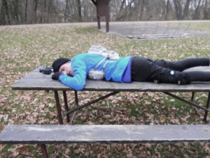
They claimed to have never been tent camping before, so Allison and I decided to check out Kettle Moraine before spending the next day at Noah’s Ark waterpark in the Wisconsin Dells.
We only hiked 2 miles or so on Saturday (it was humid and the temperature was pushing 90 degrees…the girls could only push this old man so far).

The Three Stoogettes

Meredith and Allison

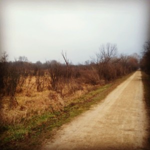
The trail was short, but it gave us quite a bit of variety. We followed the Ice Age trail through a prairie (see above), then turned off into a wooded section to see “Brady’s Rocks” (see below).

Sisters and I on one of the rocks
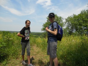
Caroline

Allison and the girls went swimming in a lake that afternoon, then we secured a campsite and set up the tent:

Setting up the tent

Tossing a frisbee

Published in: on July 17, 2011 at 1:36 pm  Comments (5)  

Black River State Forest

Yes, our epic trip out west is over. No, the blog isn’t dead.

A few weeks ago, my brother and I took a short backpacking trip in Black River State Forest – about 3 hours northwest of Milwaukee. Allison was unfortunately not able to join us, as she was visiting her friend Krista in northern Indiana (an equally “daring deed,” to be sure).

The forest offered ~30 miles of primitive trails – used predominantly by backpackers, mountain bikers, and cross-country skiers in the winter.

The Thinker

Between mid-afternoon Saturday and mid-morning Sunday, we hiked approximately 11 miles – stopping periodically to take in the scenery, climb on rocks, etc.

Open clearing near the Ridge Trail

Testing out a small cliff

The only major inconvenience was the bugs. Wisconsin is apparently notorious for its early-summer flies and mosquitoes. Every ten minutes or so, Trent and I would stop to pluck off 2-3 ticks we’d pick up from walking through the tall grass.
Trent located a pretty nice campsite up on a ridge, and we were able to make a fire and enjoy some freeze-dried dinners.

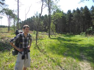
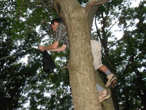
Rigging a food line

We had a good time, but I’ll probably try out some other parks/forests in Wisconsin before returning to Black River. Allison and I are thinking about maybe doing a section of the Ice Age trail when we get a chance (http://en.wikipedia.org/wiki/Ice_Age_Trail).

Published in: on July 17, 2011 at 1:09 pm  Comments (2)