Horn Peak

After leaving the Grand Canyon, Allison and I spent several days with my family at the Horn Creek family camp in Colorado. On June 7, we all set out to climb Horn Peak (elevation 13,450’).

We began the hike around 6:15am, reached the summit at 11:15am, and returned to camp at 4:20pm.

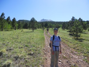
Setting off

The first few miles were steep, but not terribly difficult. We had to leave the trail a few times to avoid snow drifts, but the three guides accompanying us knew the route pretty well.

Above the tree-line

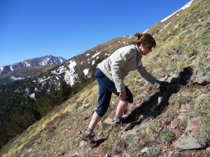
Mom

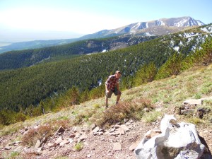
The real challenge came when we reached the tree-line and started a steep, exposed climb up to the false summit. Aside from the thin air and dizzying heights, we got to deal with powerful wind gusting at 45-50mph.

Dad

Dad nearing the false summit

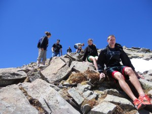
There were a few tears, but Mom, Dad, Trent, Meredith, Caroline, Allison and I all made it to the false summit in one piece. Two of the guides were still with us, but the third stayed back with another man and his daughter who couldn’t handle the challenge.

Resting on the false summit

Caroline and Allison taking a break

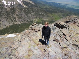
The ridge between the false summit and the true summit was less steep, but much more rocky. Fortunately, the wind had died down enough by now for us to hear each other talk.

Trent and Meredith

Meredith clinging on for dear life

Allison and I at the summit

After making it to the peak, we ate some snacks and took pictures for this year’s Christmas cards. Both my sisters thought the whole idea of climbing a mountain was stupid in the first place, so I think they were only too glad to start the descent.

Climbing down

Caroline

Returning to camp (Horn Peak in background)

I should also mention that Caroline made the climb with a broken elbow, and Trent had three fractured vertebrae (leading to several “Brokeback Mountain” jokes).

Approximate Total Distance: 9.0 miles

Published in: on June 12, 2011 at 7:52 pm  Comments (4)  

Grand Canyon Backpacking, Part 2

Since we had the rest of the day at our disposal, we walked a short distance up the North Kaibab trail before turning down the Clear Creek trail. Though we only walked 5 miles or so, we climbed high enough to gain some nice views of the Colorado River and Phantom Ranch.

Bright Angel camp (2nd night)

Looking down on Phantom Ranch

The ranch is a primitive collection of cabins and bunkhouses popular among those who arrive via mule or raft; reservations supposedly fill up a year in advance.

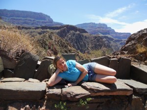
Stone bench along the Clear Creek trail

We returned to our campsite fairly early in the afternoon, since we both thought it best to rest up for the long climb ahead of us the next day. I took a siesta while Allison worked on her thumb-twiddling skills.

After cooling off in the stream and cooking dinner (chicken vindaloo for myself and beef stroganoff for Allison), we retired early.

Dinner

Friday was our designated “death march” day – 14.0 miles on the North Kaibab trail gaining 5761’ in elevation (with our heavy packs) in order to reach the North Rim, followed by another 5.3 miles of hiking on the rim between the trailhead, lodge, and campground.

Way too early to be hiking...

Needless to say, we hit the trail before dawn (4:29am by my watch) in order to stay cool. The first 7.2 miles of the hike was a nice and gradual path through a box canyon. We made great time, and even stopped for a short side trip to see Ribbon Falls (0.6 miles).

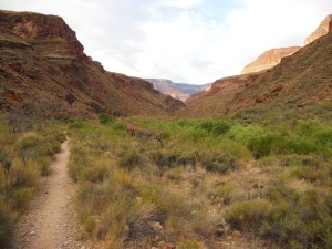
Easy first stretch through a side canyon

Looking down on Ribbon Falls

Part of the North Rim

We took a short break for “lunch” in Cottonwood campground around 8:00am before tackling the 6.8 miles of brutal switchbacks separating us from the North Rim. Although considerably less popular than trails on the South Rim, Allison and I both thought the North Kaibab trail was the most scenic of any we’d hiked.

Starting the climb

“I’d happily pay fifty bucks for a hamburger right now.”

North Kaibab trail

Along the way we got passed by two guys with Camelbacks who seemed really impressed that we were hauling our packs all the way up the North Rim in one morning. It turns out they were runners who’d started at the same time as us…from the South Rim. [Our turn to be impressed]

Matt on the Red Wall section

Allison on the trail

The final 1.7 mile stretch from Supai Tunnel to the trailhead was steep, agonizing, and covered in mule poo. We’d passed several helicopter pads on the way up, however, and knew there were actually two ways out of the canyon. Unfortunately, one of them bills for five grand. So we pressed on.

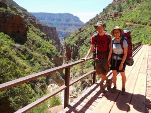
Crossing a bridge

We finally made it to the top around 12:30pm, where we were rewarded with the best campsite in the park (reserved exclusively for backpackers and cyclists). Our tent was perched mere feet from the rim of the canyon.

North Rim camp (3rd night)

The trip finally ended on Saturday morning when we forked over $160 for the five-hour shuttle ride back to the South Rim (only 10 miles as the bird flies, but 200+ by car).

Approximate Total Distance: 37.8 miles

Published in: on June 8, 2011 at 12:06 am  Comments (5)  

Grand Canyon Backpacking, Part 1

The first leg of our backpacking trip was fairly easy – a 0.4 mile walk to the Bright Angel trailhead and 4.8 mile descent to Indian Gardens. This is probably the most popular section of trail in the entire park, so we had to do a bit of maneuvering to get past certain overweight tourists with our cumbersome packs.

Cliffs along Bright Angel

Bright Angel trail

This is something we’ve noticed at all the national parks we’ve visited. The short and easy trails are always packed with out-of-shape Americans (95%+), while the more strenuous backcountry trails are heavily populated with athletic Europeans (50%+). We honestly hear as much French and German on the longer hikes as we do English.

Escaping the sun

After a couple short rest stops, we arrived at the Indian Gardens campground around 4:00pm. We took a few minutes to select a campsite (complete with picnic table and ammo boxes for food storage) and set up the tent, then walked another 1.5 miles to Plateau Point.

Indian Gardens camp (1st night)

Hiking to Plateau Point

Plateau Point serves as a nice “mid-way” viewpoint in the canyon, ~1500’ above the Colorado River and ~3000’ below the South Rim. We spent a little time taking pictures and scrambling on rock formations, then started walking back to camp.

Daredevil Allison

Climbing up to a vantage point

View of Indian Gardens (oasis) and South Rim

On the way, I noticed a rattling noise a few feet from where Allison was walking. After some cautious poking around, I successfully located a small rattlesnake hiding in the tall grass. We hastily retreated back to camp. I killed it with a rock and cooked it for dinner.

Rattlesnake

Our new backpacking stove really did pay for itself that first night – hot Ramen noodles taste even better after a long day of hiking.

Cooking dinner

Since our campground for the following night was only 4.7 miles away, we decided to sleep in. By “sleep in,” I mean that we rolled out of bed at 6:30am and were the very last people to vacate the camp. For obvious reasons, most hikers prefer to start early in the desert.

Preparing to descend Devil's Corkscrew

View from bottom of canyon

The section of trail between Indian Gardens and the Bright Angel campground is sometimes referred to as “Devil’s Corkscrew” – several miles of jagged switchbacks leading down to the Colorado River. We played tortoise and the hare with an out-of-shape jogger for most of the way (yep, the tortoise won), and crossed the river around 9:30am.

Arriving at the Colorado River

Crossing the river

One of the advantages to arriving early was that we were able to occupy a choice campsite along the creek. After wolfing down some peanut butter sandwiches and tuna, we dropped our packs and left for a short day hike.

(Continued in separate post)

Published in: on June 7, 2011 at 11:35 pm  Comments (1)  

Grand Canyon Day Hikes

After suffering from rain/snow/hail for 13 of the first 15 days of the trip, the weather has finally cleared. Mostly sunny; highs in the 80’s and 90’s; lows in the 30’s and 40’s.

We arrived in Grand Canyon National Park on Sunday afternoon and spent a few hours visiting some of the “touristy” attractions and walking along the Rim Trail (roughly 2.5 miles). We also talked with a ranger in the backcountry office and received a waitlist number for a trip into the canyon. The spaces are extremely limited for walk-ins like us, since most backpackers book spots 4 months in advance.

View from the rim

We camped in the Kaibab National Forest on Sunday night – pulling the car off a dirt road and setting up in a grove of pine trees. Allison made spaghetti on the camp stove, and I talked her into playing a few games of “poor man’s bocce ball” using pine cones and some rocks.

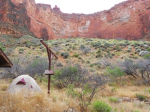
Kaibab National Forest campsite
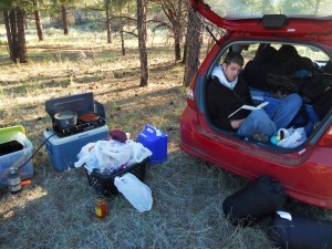
Reading in my room

Early Monday morning, we drove to the backcountry office and managed to get the last available permit! We’ll be leaving on Wednesday afternoon, then spending two nights in the canyon and a third on the opposite (north) rim. Packing for three nights was a bit of a challenge, since the temperature will likely range from 30F to 100F. We also invested in a lightweight backpacking stove, so we’ll be able to enjoy Ramen noodles and freeze-dried meals. If you click on this picture, you’ll be able to see our proposed route:

Proposed route highlighted in red

After securing our permit, we took a shuttle to the Hermit’s Rest trailhead. Not wanting to burn ourselves out, we only hiked about 9.0 total miles for the day. Following the trail into the canyon, we took some branch-offs to see the Santa Maria Spring and the Dripping Spring (not super exciting to be honest, unless you’re really into watching water drip out the side of a cliff).

Allison pointing out the trailhead

Dripping Spring

The trail featured countless switchbacks and required a small amount of scrambling, but it offered some great views.
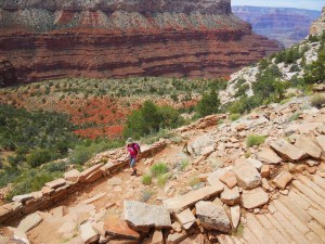
Allison climbing the switchbacks

View into the canyon
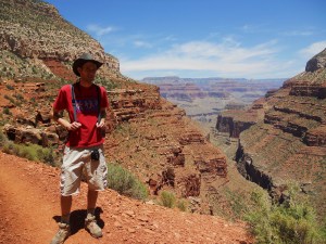
(slightly different) View into the canyon

Allison, hot on the trail (double-pun intended)

Rather than descending into the “main canyon,” the Hermit Trail actually winds through a scenic side canyon. It’s far less traveled (from what I understand) than the more popular trails, but it also lacks the sheer drop-offs and panoramic views we’ll be seeing later in the week. It’s very tame, so I’d definitely recommend it for anyone afraid of heights.

On Wednesday morning, we decided there would be plenty of time for a morning hike before starting on the backpacking trip. After parking along the rim, we descended the South Kaibab trail to Skeleton Point and back (7.6 miles, including connection trail along the rim).

South Kaibab switchbacks

The South Kaibab trail is actually the shortest route to the Colorado River (7-8 miles each way, I believe), so we encountered several people attempting to make it down and back in one day. The trail follows a ridgeline into the main canyon, offering sweeping views from a number of vistas (including the aptly named “Ooh Ahh Point”).

View from "Ooh Ahh Point"

View along the trail

We made it back to the car sometime around noon, grabbed some lunch at a cafeteria, and set off for our backpacking trip around 2:00pm.

Approximate Total Distance: 19.1 miles

Published in: on June 1, 2011 at 12:35 am  Comments (2)